T52A Hallie, KY, USA - Earthquake Result Viewer
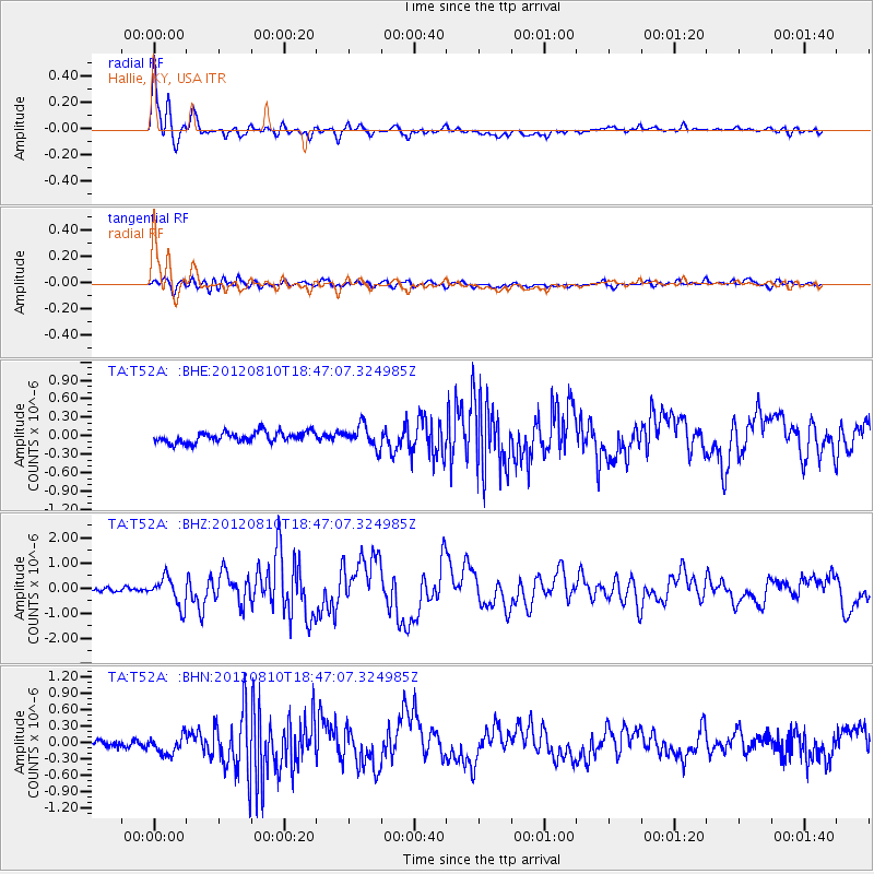
Earthquake location: Fox Islands, Aleutian Islands
Earthquake latitude/longitude: 52.6/-167.4
Earthquake time(UTC): 2012/08/10 (223) 18:37:43 GMT
Earthquake Depth: 13 km
Earthquake Magnitude: 5.9 MB, 6.2 MS, 6.2 MW, 6.2 MW
Earthquake Catalog/Contributor: WHDF/NEIC
Network: TA USArray Transportable Network (new EarthScope stations)
Station: T52A Hallie, KY, USA
Lat/Lon: 37.11 N/82.99 W
Elevation: 436 m
Distance: 58.4 deg
Az: 69.047 deg
Baz: 314.604 deg
Ray Param: 0.06284115
Estimated Moho Depth: 13.75 km
Estimated Crust Vp/Vs: 1.99
Assumed Crust Vp: 6.476 km/s
Estimated Crust Vs: 3.254 km/s
Estimated Crust Poisson's Ratio: 0.33
Radial Match: 92.1176 %
Radial Bump: 400
Transverse Match: 60.953667 %
Transverse Bump: 400
SOD ConfigId: 469095
Insert Time: 2013-02-22 06:14:31.797 +0000
GWidth: 2.5
Max Bumps: 400
Tol: 0.001

Signal To Noise

ChannelStoNSTALTA
TA:T52A: :BHZ:20120810T18:47:07.324985Z8.4414815.65673E-76.7011115E-8
TA:T52A: :BHN:20120810T18:47:07.324985Z1.58864332.0057891E-71.2625799E-7
TA:T52A: :BHE:20120810T18:47:07.324985Z2.0649611.7594705E-78.5206E-8
Arrivals
Ps2.2 SECOND
PpPs6.1 SECOND
PsPs/PpSs8.3 SECOND