S51A Beattyville, KY, USA - Earthquake Result Viewer
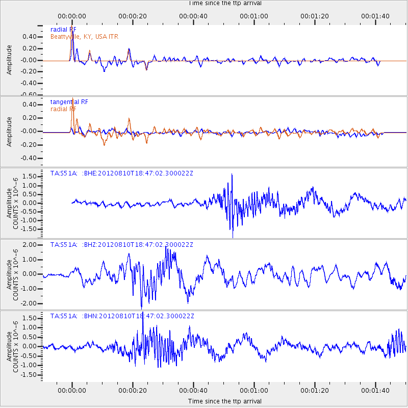
Earthquake location: Fox Islands, Aleutian Islands
Earthquake latitude/longitude: 52.6/-167.4
Earthquake time(UTC): 2012/08/10 (223) 18:37:43 GMT
Earthquake Depth: 13 km
Earthquake Magnitude: 5.9 MB, 6.2 MS, 6.2 MW, 6.2 MW
Earthquake Catalog/Contributor: WHDF/NEIC
Network: TA USArray Transportable Network (new EarthScope stations)
Station: S51A Beattyville, KY, USA
Lat/Lon: 37.64 N/83.59 W
Elevation: 286 m
Distance: 57.7 deg
Az: 69.0 deg
Baz: 314.211 deg
Ray Param: 0.0633075
Estimated Moho Depth: 46.0 km
Estimated Crust Vp/Vs: 1.79
Assumed Crust Vp: 6.476 km/s
Estimated Crust Vs: 3.618 km/s
Estimated Crust Poisson's Ratio: 0.27
Radial Match: 91.75063 %
Radial Bump: 400
Transverse Match: 56.30177 %
Transverse Bump: 400
SOD ConfigId: 469095
Insert Time: 2013-02-22 06:14:43.427 +0000
GWidth: 2.5
Max Bumps: 400
Tol: 0.001

Signal To Noise

ChannelStoNSTALTA
TA:S51A: :BHZ:20120810T18:47:02.300022Z4.6253463.8713438E-78.369847E-8
TA:S51A: :BHN:20120810T18:47:02.300022Z1.14968379.3553524E-88.137327E-8
TA:S51A: :BHE:20120810T18:47:02.300022Z1.45283751.3850082E-79.533126E-8
Arrivals
Ps5.9 SECOND
PpPs19 SECOND
PsPs/PpSs25 SECOND