
V53A Saluda, NC, USA - Earthquake Result Viewer
| ||||||||||||||||||
| ||||||||||||||||||
| ||||||||||||||||||
|
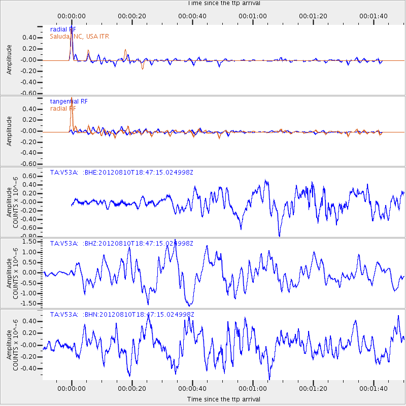
Signal To Noise
| Channel | StoN | STA | LTA |
| TA:V53A: :BHZ:20120810T18:47:15.024998Z | 6.771859 | 4.0202283E-7 | 5.9366688E-8 |
| TA:V53A: :BHN:20120810T18:47:15.024998Z | 3.2758381 | 1.5156333E-7 | 4.6267036E-8 |
| TA:V53A: :BHE:20120810T18:47:15.024998Z | 2.2833714 | 1.2691731E-7 | 5.55833E-8 |
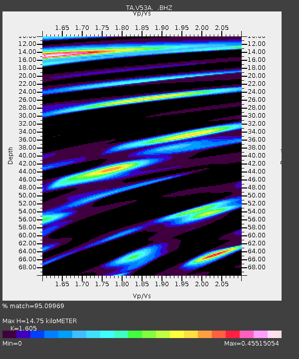
| Arrivals | |
| Ps | 1.5 SECOND |
| PpPs | 5.7 SECOND |
| PsPs/PpSs | 7.2 SECOND |

