U53A Fall Branch, TN, USA - Earthquake Result Viewer
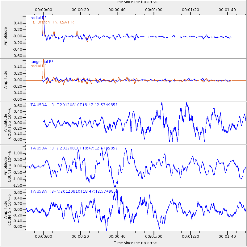
Earthquake location: Fox Islands, Aleutian Islands
Earthquake latitude/longitude: 52.6/-167.4
Earthquake time(UTC): 2012/08/10 (223) 18:37:43 GMT
Earthquake Depth: 13 km
Earthquake Magnitude: 5.9 MB, 6.2 MS, 6.2 MW, 6.2 MW
Earthquake Catalog/Contributor: WHDF/NEIC
Network: TA USArray Transportable Network (new EarthScope stations)
Station: U53A Fall Branch, TN, USA
Lat/Lon: 36.36 N/82.58 W
Elevation: 559 m
Distance: 59.2 deg
Az: 69.391 deg
Baz: 315.026 deg
Ray Param: 0.062346797
Estimated Moho Depth: 45.25 km
Estimated Crust Vp/Vs: 1.75
Assumed Crust Vp: 6.476 km/s
Estimated Crust Vs: 3.701 km/s
Estimated Crust Poisson's Ratio: 0.26
Radial Match: 95.86292 %
Radial Bump: 392
Transverse Match: 63.439907 %
Transverse Bump: 400
SOD ConfigId: 469095
Insert Time: 2013-02-22 06:15:00.227 +0000
GWidth: 2.5
Max Bumps: 400
Tol: 0.001

Signal To Noise

ChannelStoNSTALTA
TA:U53A: :BHZ:20120810T18:47:12.574985Z5.09390453.5428258E-76.9550296E-8
TA:U53A: :BHN:20120810T18:47:12.574985Z2.36579041.2842365E-75.4283614E-8
TA:U53A: :BHE:20120810T18:47:12.574985Z2.13385271.5980183E-77.4888874E-8
Arrivals
Ps5.5 SECOND
PpPs18 SECOND
PsPs/PpSs24 SECOND