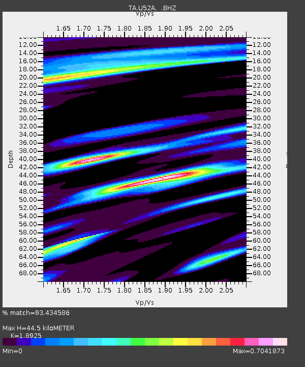
U52A Thorn Hill, TN, USA - Earthquake Result Viewer
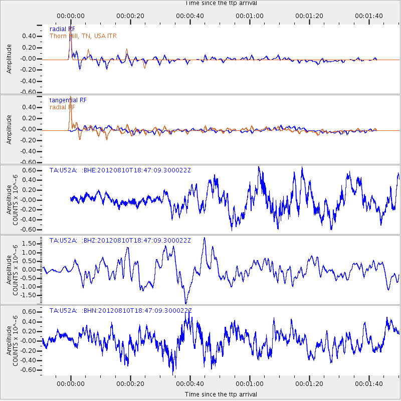
Earthquake location: Fox Islands, Aleutian Islands
Earthquake latitude/longitude: 52.6/-167.4
Earthquake time(UTC): 2012/08/10 (223) 18:37:43 GMT
Earthquake Depth: 13 km
Earthquake Magnitude: 5.9 MB, 6.2 MS, 6.2 MW, 6.2 MW
Earthquake Catalog/Contributor: WHDF/NEIC
Network: TA USArray Transportable Network (new EarthScope stations)
Station: U52A Thorn Hill, TN, USA
Lat/Lon: 36.39 N/83.37 W
Elevation: 510 m
Distance: 58.7 deg
Az: 69.894 deg
Baz: 314.818 deg
Ray Param: 0.06265612
Estimated Moho Depth: 44.5 km
Estimated Crust Vp/Vs: 1.89
Assumed Crust Vp: 6.476 km/s
Estimated Crust Vs: 3.422 km/s
Estimated Crust Poisson's Ratio: 0.31
Radial Match: 93.434586 %
Radial Bump: 400
Transverse Match: 57.010017 %
Transverse Bump: 400
SOD ConfigId: 469095
Insert Time: 2013-02-22 06:15:23.932 +0000
GWidth: 2.5
Max Bumps: 400
Tol: 0.001

Signal To Noise

ChannelStoNSTALTA
TA:U52A: :BHZ:20120810T18:47:09.300022Z5.1701444.1114922E-77.9523744E-8
TA:U52A: :BHN:20120810T18:47:09.300022Z1.76145241.5236628E-78.650037E-8
TA:U52A: :BHE:20120810T18:47:09.300022Z1.92787431.4632262E-77.589842E-8
Arrivals
Ps6.4 SECOND
PpPs19 SECOND
PsPs/PpSs25 SECOND