U51A La Follette, TN, USA - Earthquake Result Viewer
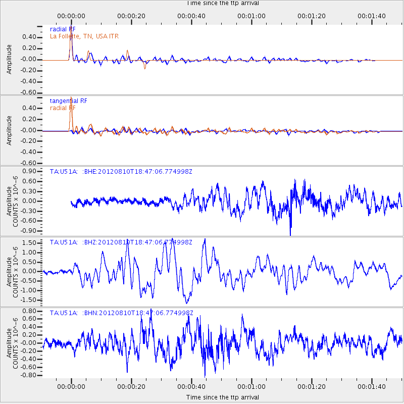
Earthquake location: Fox Islands, Aleutian Islands
Earthquake latitude/longitude: 52.6/-167.4
Earthquake time(UTC): 2012/08/10 (223) 18:37:43 GMT
Earthquake Depth: 13 km
Earthquake Magnitude: 5.9 MB, 6.2 MS, 6.2 MW, 6.2 MW
Earthquake Catalog/Contributor: WHDF/NEIC
Network: TA USArray Transportable Network (new EarthScope stations)
Station: U51A La Follette, TN, USA
Lat/Lon: 36.38 N/84.02 W
Elevation: 472 m
Distance: 58.4 deg
Az: 70.338 deg
Baz: 314.667 deg
Ray Param: 0.06289218
Estimated Moho Depth: 45.75 km
Estimated Crust Vp/Vs: 1.85
Assumed Crust Vp: 6.476 km/s
Estimated Crust Vs: 3.51 km/s
Estimated Crust Poisson's Ratio: 0.29
Radial Match: 94.10537 %
Radial Bump: 389
Transverse Match: 69.44442 %
Transverse Bump: 400
SOD ConfigId: 469095
Insert Time: 2013-02-22 06:15:28.620 +0000
GWidth: 2.5
Max Bumps: 400
Tol: 0.001

Signal To Noise

ChannelStoNSTALTA
TA:U51A: :BHZ:20120810T18:47:06.774998Z5.0224123.5842803E-77.136572E-8
TA:U51A: :BHN:20120810T18:47:06.774998Z1.98535441.3652775E-76.876745E-8
TA:U51A: :BHE:20120810T18:47:06.774998Z1.507619.600204E-86.36783E-8
Arrivals
Ps6.3 SECOND
PpPs19 SECOND
PsPs/PpSs25 SECOND