N50A Nevada, OH, USA - Earthquake Result Viewer
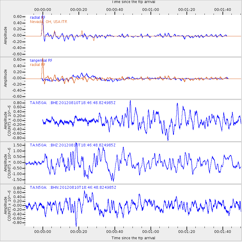
Earthquake location: Fox Islands, Aleutian Islands
Earthquake latitude/longitude: 52.6/-167.4
Earthquake time(UTC): 2012/08/10 (223) 18:37:43 GMT
Earthquake Depth: 13 km
Earthquake Magnitude: 5.9 MB, 6.2 MS, 6.2 MW, 6.2 MW
Earthquake Catalog/Contributor: WHDF/NEIC
Network: TA USArray Transportable Network (new EarthScope stations)
Station: N50A Nevada, OH, USA
Lat/Lon: 40.77 N/83.15 W
Elevation: 277 m
Distance: 55.8 deg
Az: 66.004 deg
Baz: 312.849 deg
Ray Param: 0.06454319
Estimated Moho Depth: 14.75 km
Estimated Crust Vp/Vs: 2.10
Assumed Crust Vp: 6.498 km/s
Estimated Crust Vs: 3.098 km/s
Estimated Crust Poisson's Ratio: 0.35
Radial Match: 90.24824 %
Radial Bump: 400
Transverse Match: 58.788013 %
Transverse Bump: 400
SOD ConfigId: 469095
Insert Time: 2013-02-22 06:16:22.360 +0000
GWidth: 2.5
Max Bumps: 400
Tol: 0.001

Signal To Noise

ChannelStoNSTALTA
TA:N50A: :BHZ:20120810T18:46:48.824985Z6.19983634.828997E-77.78891E-8
TA:N50A: :BHN:20120810T18:46:48.824985Z1.91867921.8856517E-79.827863E-8
TA:N50A: :BHE:20120810T18:46:48.824985Z1.79509821.6127045E-78.983935E-8
Arrivals
Ps2.6 SECOND
PpPs6.7 SECOND
PsPs/PpSs9.3 SECOND