
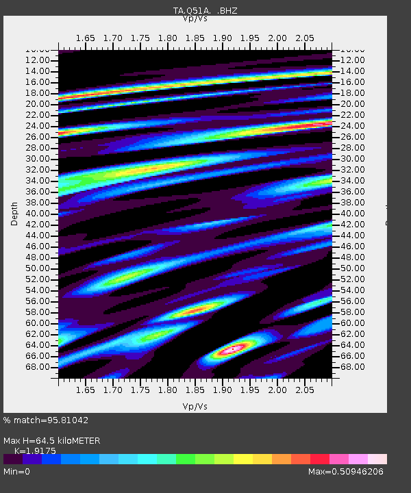
Q51A Peebles, OH, USA - Earthquake Result Viewer
| ||||||||||||||||||
| ||||||||||||||||||
| ||||||||||||||||||
|
Signal To Noise
| Channel | StoN | STA | LTA |
| TA:Q51A: :BHZ:20120810T18:46:56.524998Z | 5.5746813 | 5.272239E-7 | 9.4574716E-8 |
| TA:Q51A: :BHN:20120810T18:46:56.524998Z | 2.2588258 | 1.6089858E-7 | 7.123107E-8 |
| TA:Q51A: :BHE:20120810T18:46:56.524998Z | 3.3442273 | 2.9729566E-7 | 8.889816E-8 |
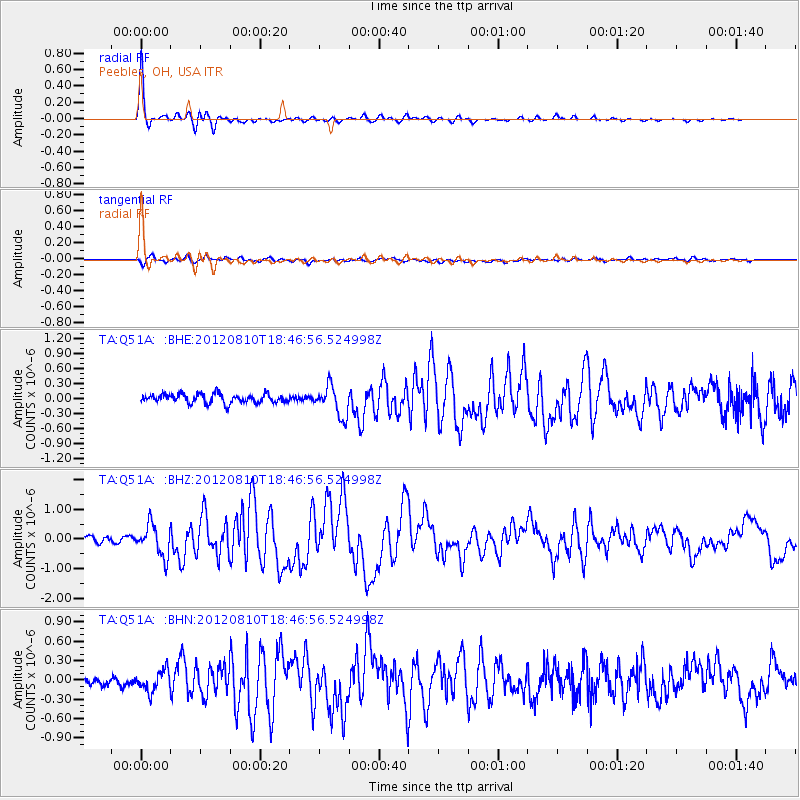
| Arrivals | |
| Ps | 9.9 SECOND |
| PpPs | 29 SECOND |
| PsPs/PpSs | 39 SECOND |

