M50A Fremont, OH, USA - Earthquake Result Viewer
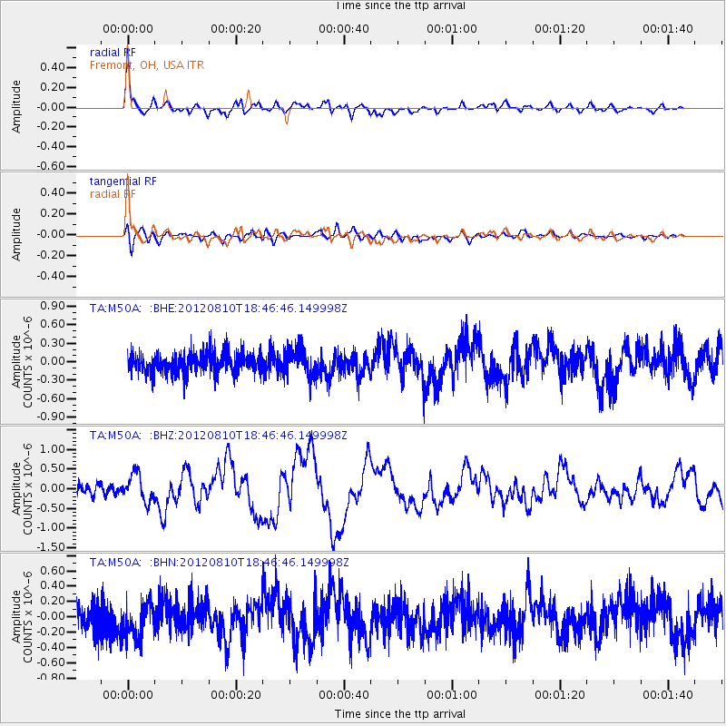
Earthquake location: Fox Islands, Aleutian Islands
Earthquake latitude/longitude: 52.6/-167.4
Earthquake time(UTC): 2012/08/10 (223) 18:37:43 GMT
Earthquake Depth: 13 km
Earthquake Magnitude: 5.9 MB, 6.2 MS, 6.2 MW, 6.2 MW
Earthquake Catalog/Contributor: WHDF/NEIC
Network: TA USArray Transportable Network (new EarthScope stations)
Station: M50A Fremont, OH, USA
Lat/Lon: 41.40 N/83.04 W
Elevation: 176 m
Distance: 55.4 deg
Az: 65.376 deg
Baz: 312.564 deg
Ray Param: 0.06478395
Estimated Moho Depth: 28.0 km
Estimated Crust Vp/Vs: 2.07
Assumed Crust Vp: 6.498 km/s
Estimated Crust Vs: 3.139 km/s
Estimated Crust Poisson's Ratio: 0.35
Radial Match: 86.33423 %
Radial Bump: 400
Transverse Match: 66.11746 %
Transverse Bump: 400
SOD ConfigId: 469095
Insert Time: 2013-02-22 06:17:30.592 +0000
GWidth: 2.5
Max Bumps: 400
Tol: 0.001

Signal To Noise

ChannelStoNSTALTA
TA:M50A: :BHZ:20120810T18:46:46.149998Z2.9433023.5231648E-71.1970108E-7
TA:M50A: :BHN:20120810T18:46:46.149998Z1.17393052.3571262E-72.0078924E-7
TA:M50A: :BHE:20120810T18:46:46.149998Z1.40391032.2700449E-71.6169444E-7
Arrivals
Ps4.8 SECOND
PpPs13 SECOND
PsPs/PpSs17 SECOND