
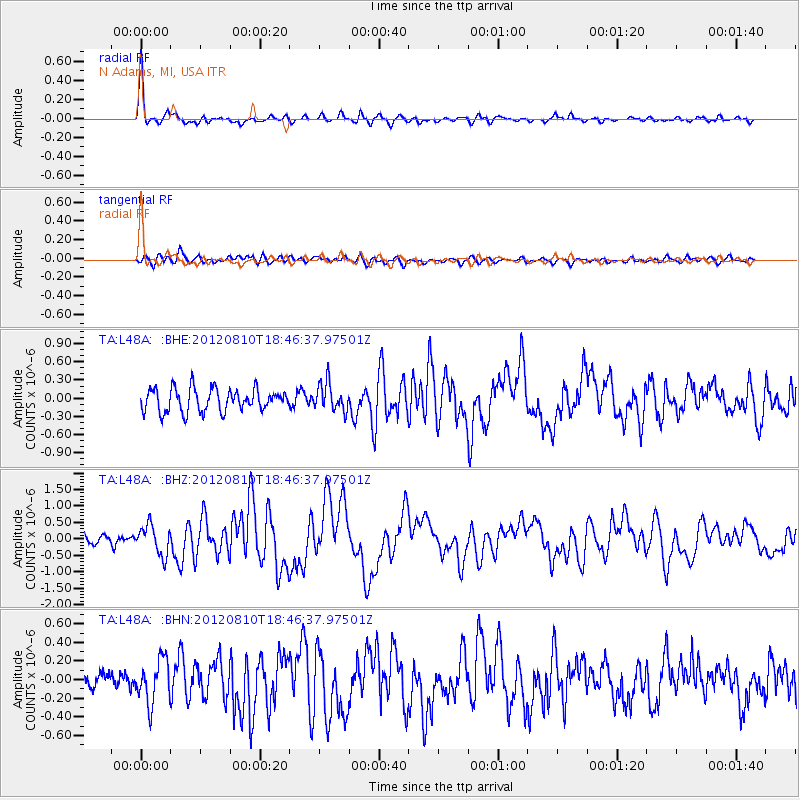
L48A N Adams, MI, USA - Earthquake Result Viewer
| ||||||||||||||||||
| ||||||||||||||||||
| ||||||||||||||||||
|
Signal To Noise
| Channel | StoN | STA | LTA |
| TA:L48A: :BHZ:20120810T18:46:37.97501Z | 2.6914184 | 4.482971E-7 | 1.6656537E-7 |
| TA:L48A: :BHN:20120810T18:46:37.97501Z | 2.5357988 | 2.3624126E-7 | 9.316247E-8 |
| TA:L48A: :BHE:20120810T18:46:37.97501Z | 1.2258788 | 2.277166E-7 | 1.8575783E-7 |
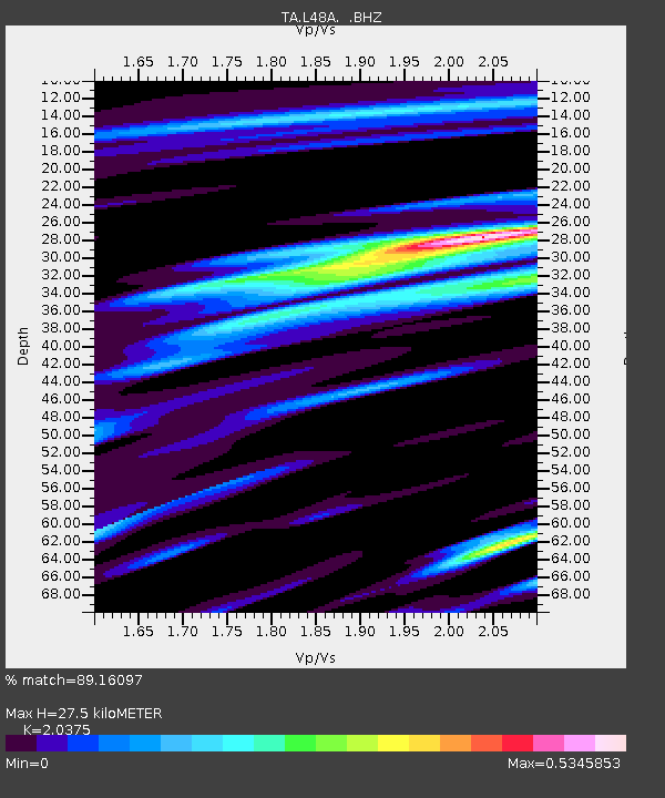
| Arrivals | |
| Ps | 4.6 SECOND |
| PpPs | 12 SECOND |
| PsPs/PpSs | 17 SECOND |

