You are here: Home > Network List > TA - USArray Transportable Network (new EarthScope stations) Stations List
> Station C38A Sawbill Landing (USFS), Superior Nat. Forest, MN, > Earthquake Result Viewer
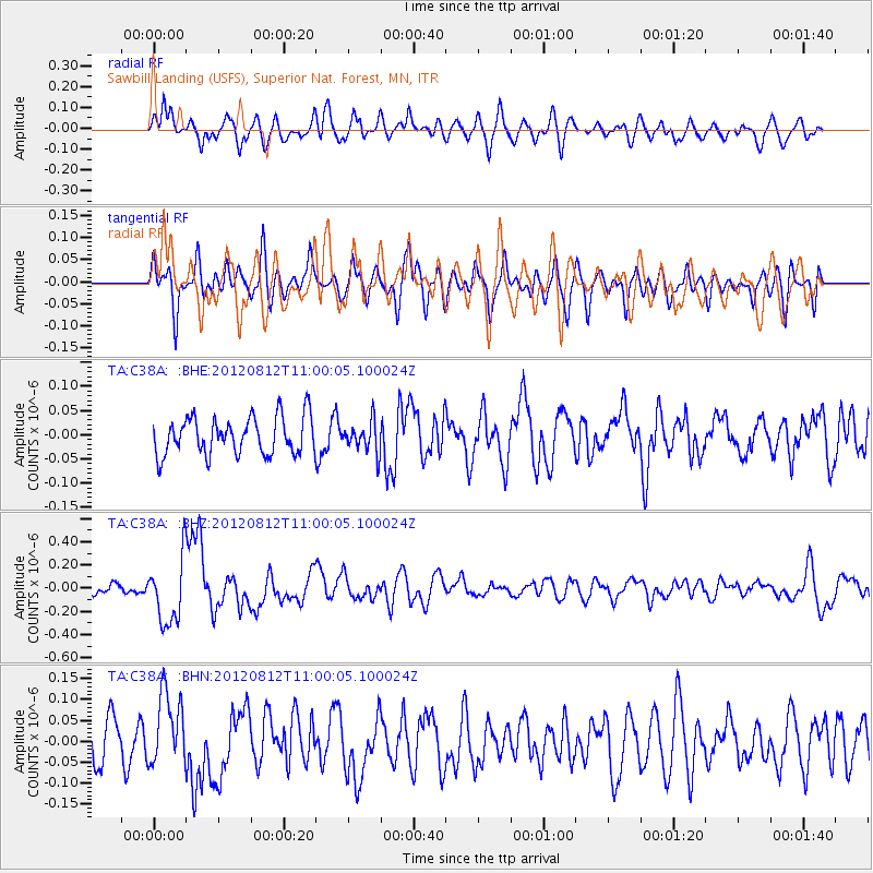
C38A Sawbill Landing (USFS), Superior Nat. Forest, MN, - Earthquake Result Viewer
*The percent match for this event was below the threshold and hence no stack was calculated.
| Earthquake location: |
Xizang |
| Earthquake latitude/longitude: |
35.7/82.5 |
| Earthquake time(UTC): |
2012/08/12 (225) 10:47:06 GMT |
| Earthquake Depth: |
13 km |
| Earthquake Magnitude: |
6.1 MB, 6.1 MS, 6.2 MW, 6.3 MW |
| Earthquake Catalog/Contributor: |
WHDF/NEIC |
|
| Network: |
TA USArray Transportable Network (new EarthScope stations) |
| Station: |
C38A Sawbill Landing (USFS), Superior Nat. Forest, MN, |
| Lat/Lon: |
47.72 N/91.27 W |
| Elevation: |
498 m |
|
| Distance: |
96.8 deg |
| Az: |
355.782 deg |
| Baz: |
5.089 deg |
| Ray Param: |
$rayparam |
*The percent match for this event was below the threshold and hence was not used in the summary stack. |
|
| Radial Match: |
60.99297 % |
| Radial Bump: |
400 |
| Transverse Match: |
68.75652 % |
| Transverse Bump: |
400 |
| SOD ConfigId: |
469095 |
| Insert Time: |
2013-02-22 06:29:13.719 +0000 |
| GWidth: |
2.5 |
| Max Bumps: |
400 |
| Tol: |
0.001 |
|
Signal To Noise
| Channel | StoN | STA | LTA |
| TA:C38A: :BHZ:20120812T11:00:05.100024Z | 4.179107 | 2.8055976E-7 | 6.71339E-8 |
| TA:C38A: :BHN:20120812T11:00:05.100024Z | 1.790517 | 8.622813E-8 | 4.815823E-8 |
| TA:C38A: :BHE:20120812T11:00:05.100024Z | 0.804993 | 3.088958E-8 | 3.8372484E-8 |
| Arrivals |
| Ps | |
| PpPs | |
| PsPs/PpSs | |


