You are here: Home > Network List > GS - US Geological Survey Networks Stations List
> Station DEC09 Decatur Surface Seismic Site, Decatur, IL, USA > Earthquake Result Viewer
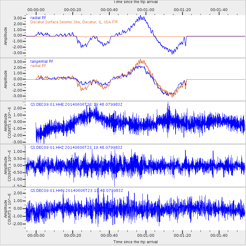
DEC09 Decatur Surface Seismic Site, Decatur, IL, USA - Earthquake Result Viewer
*The percent match for this event was below the threshold and hence no stack was calculated.
| Earthquake location: |
Samoa Islands Region |
| Earthquake latitude/longitude: |
-14.9/-174.9 |
| Earthquake time(UTC): |
2014/06/06 (157) 23:06:50 GMT |
| Earthquake Depth: |
10 km |
| Earthquake Magnitude: |
5.5 MW |
| Earthquake Catalog/Contributor: |
ISC/ISC |
|
| Network: |
GS US Geological Survey Networks |
| Station: |
DEC09 Decatur Surface Seismic Site, Decatur, IL, USA |
| Lat/Lon: |
39.87 N/88.92 W |
| Elevation: |
207 m |
|
| Distance: |
96.4 deg |
| Az: |
50.583 deg |
| Baz: |
256.021 deg |
| Ray Param: |
$rayparam |
*The percent match for this event was below the threshold and hence was not used in the summary stack. |
|
| Radial Match: |
53.868855 % |
| Radial Bump: |
400 |
| Transverse Match: |
63.4825 % |
| Transverse Bump: |
400 |
| SOD ConfigId: |
3390531 |
| Insert Time: |
2019-04-12 04:41:51.017 +0000 |
| GWidth: |
2.5 |
| Max Bumps: |
400 |
| Tol: |
0.001 |
|
Signal To Noise
| Channel | StoN | STA | LTA |
| GS:DEC09:01:HHZ:20140606T23:19:48.079983Z | 1.1092982 | 3.1866102E-7 | 2.8726362E-7 |
| GS:DEC09:01:HHN:20140606T23:19:48.079983Z | 1.356571 | 1.0624173E-6 | 7.8316384E-7 |
| GS:DEC09:01:HHE:20140606T23:19:48.079983Z | 2.252795 | 1.9927315E-6 | 8.8455977E-7 |
| Arrivals |
| Ps | |
| PpPs | |
| PsPs/PpSs | |


