You are here: Home > Network List > US - United States National Seismic Network Stations List
> Station MNTX Cornudas Mountains, Texas, USA > Earthquake Result Viewer
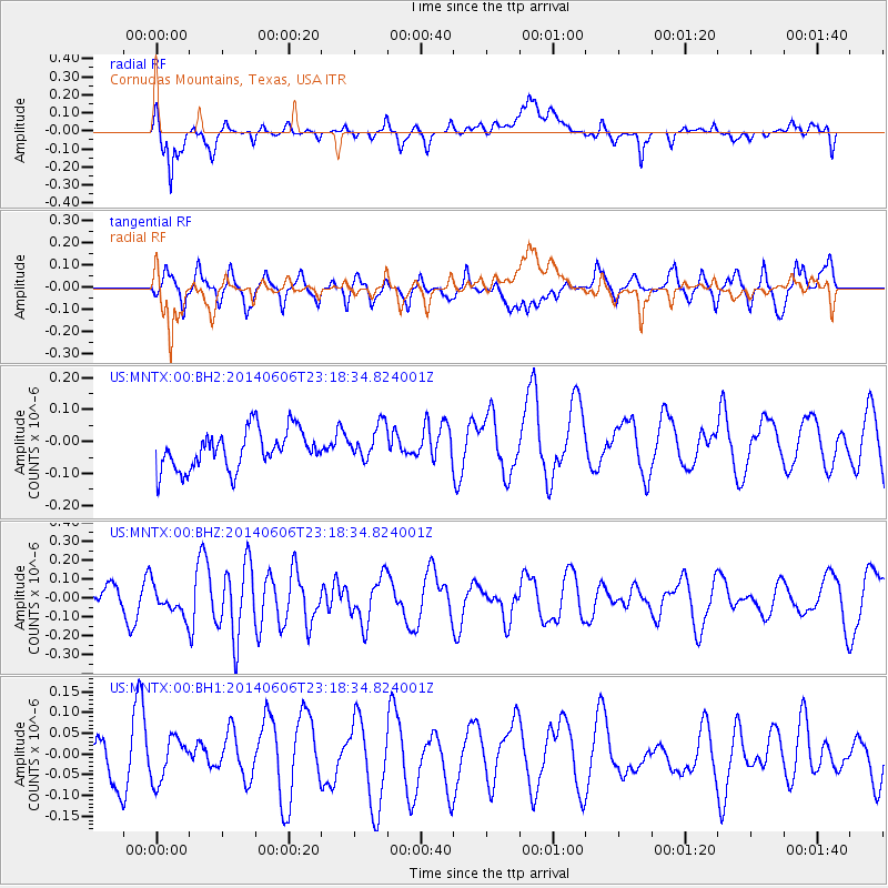
MNTX Cornudas Mountains, Texas, USA - Earthquake Result Viewer
*The percent match for this event was below the threshold and hence no stack was calculated.
| Earthquake location: |
Samoa Islands Region |
| Earthquake latitude/longitude: |
-14.9/-174.9 |
| Earthquake time(UTC): |
2014/06/06 (157) 23:06:50 GMT |
| Earthquake Depth: |
10 km |
| Earthquake Magnitude: |
5.5 MW |
| Earthquake Catalog/Contributor: |
ISC/ISC |
|
| Network: |
US United States National Seismic Network |
| Station: |
MNTX Cornudas Mountains, Texas, USA |
| Lat/Lon: |
31.70 N/105.38 W |
| Elevation: |
404 m |
|
| Distance: |
81.1 deg |
| Az: |
53.933 deg |
| Baz: |
246.443 deg |
| Ray Param: |
$rayparam |
*The percent match for this event was below the threshold and hence was not used in the summary stack. |
|
| Radial Match: |
68.936226 % |
| Radial Bump: |
400 |
| Transverse Match: |
41.18014 % |
| Transverse Bump: |
400 |
| SOD ConfigId: |
3390531 |
| Insert Time: |
2019-04-12 04:44:51.059 +0000 |
| GWidth: |
2.5 |
| Max Bumps: |
400 |
| Tol: |
0.001 |
|
Signal To Noise
| Channel | StoN | STA | LTA |
| US:MNTX:00:BHZ:20140606T23:18:34.824001Z | 0.89887613 | 7.581343E-8 | 8.434247E-8 |
| US:MNTX:00:BH1:20140606T23:18:34.824001Z | 0.9308467 | 5.2325007E-8 | 5.6212272E-8 |
| US:MNTX:00:BH2:20140606T23:18:34.824001Z | 0.92570734 | 5.6365042E-8 | 6.088862E-8 |
| Arrivals |
| Ps | |
| PpPs | |
| PsPs/PpSs | |


