You are here: Home > Network List > US - United States National Seismic Network Stations List
> Station WMOK Wichita Mountains, Oklahoma, USA > Earthquake Result Viewer
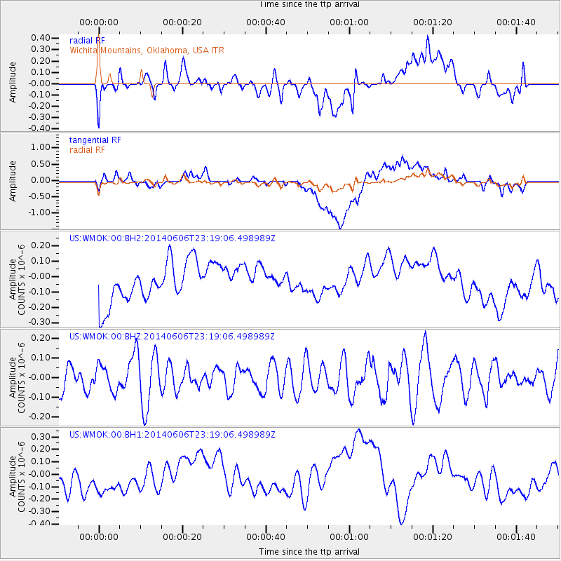
WMOK Wichita Mountains, Oklahoma, USA - Earthquake Result Viewer
*The percent match for this event was below the threshold and hence no stack was calculated.
| Earthquake location: |
Samoa Islands Region |
| Earthquake latitude/longitude: |
-14.9/-174.9 |
| Earthquake time(UTC): |
2014/06/06 (157) 23:06:50 GMT |
| Earthquake Depth: |
10 km |
| Earthquake Magnitude: |
5.5 MW |
| Earthquake Catalog/Contributor: |
ISC/ISC |
|
| Network: |
US United States National Seismic Network |
| Station: |
WMOK Wichita Mountains, Oklahoma, USA |
| Lat/Lon: |
34.74 N/98.78 W |
| Elevation: |
486 m |
|
| Distance: |
87.4 deg |
| Az: |
53.173 deg |
| Baz: |
249.97 deg |
| Ray Param: |
$rayparam |
*The percent match for this event was below the threshold and hence was not used in the summary stack. |
|
| Radial Match: |
35.687084 % |
| Radial Bump: |
400 |
| Transverse Match: |
31.816523 % |
| Transverse Bump: |
400 |
| SOD ConfigId: |
3390531 |
| Insert Time: |
2019-04-12 04:44:54.794 +0000 |
| GWidth: |
2.5 |
| Max Bumps: |
400 |
| Tol: |
0.001 |
|
Signal To Noise
| Channel | StoN | STA | LTA |
| US:WMOK:00:BHZ:20140606T23:19:06.498989Z | 0.98322564 | 6.362544E-8 | 6.4710925E-8 |
| US:WMOK:00:BH1:20140606T23:19:06.498989Z | 1.0836815 | 2.198587E-7 | 2.0288131E-7 |
| US:WMOK:00:BH2:20140606T23:19:06.498989Z | 0.8110437 | 1.02892095E-7 | 1.2686381E-7 |
| Arrivals |
| Ps | |
| PpPs | |
| PsPs/PpSs | |


