You are here: Home > Network List > G - GEOSCOPE Stations List
> Station TAM Tamanrasset, Algeria > Earthquake Result Viewer
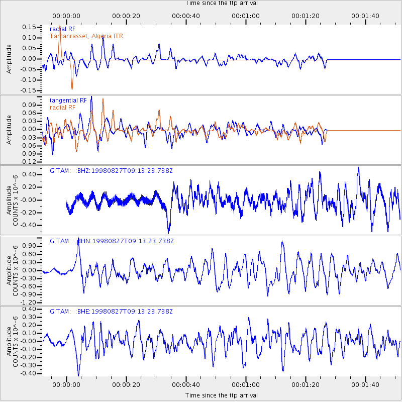
TAM Tamanrasset, Algeria - Earthquake Result Viewer
*The percent match for this event was below the threshold and hence no stack was calculated.
| Earthquake location: |
Southern Xinjiang, China |
| Earthquake latitude/longitude: |
39.7/77.3 |
| Earthquake time(UTC): |
1998/08/27 (239) 09:03:36 GMT |
| Earthquake Depth: |
33 km |
| Earthquake Magnitude: |
5.6 MB, 6.4 MS, 6.3 UNKNOWN, 6.3 MW |
| Earthquake Catalog/Contributor: |
WHDF/NEIC |
|
| Network: |
G GEOSCOPE |
| Station: |
TAM Tamanrasset, Algeria |
| Lat/Lon: |
22.79 N/5.53 E |
| Elevation: |
1377 m |
|
| Distance: |
62.1 deg |
| Az: |
277.424 deg |
| Baz: |
56.044 deg |
| Ray Param: |
$rayparam |
*The percent match for this event was below the threshold and hence was not used in the summary stack. |
|
| Radial Match: |
89.41156 % |
| Radial Bump: |
324 |
| Transverse Match: |
68.26946 % |
| Transverse Bump: |
400 |
| SOD ConfigId: |
4480 |
| Insert Time: |
2010-02-27 00:35:52.801 +0000 |
| GWidth: |
2.5 |
| Max Bumps: |
400 |
| Tol: |
0.001 |
|
Signal To Noise
| Channel | StoN | STA | LTA |
| G:TAM: :BHN:19980827T09:13:23.738Z | 6.0389295 | 4.5104352E-7 | 7.468931E-8 |
| G:TAM: :BHE:19980827T09:13:23.738Z | 3.9472814 | 1.7802695E-7 | 4.5101157E-8 |
| G:TAM: :BHZ:19980827T09:13:23.738Z | 2.714592 | 2.0273669E-7 | 7.468404E-8 |
| Arrivals |
| Ps | |
| PpPs | |
| PsPs/PpSs | |


