You are here: Home > Network List > G - GEOSCOPE Stations List
> Station TAM Tamanrasset, Algeria > Earthquake Result Viewer
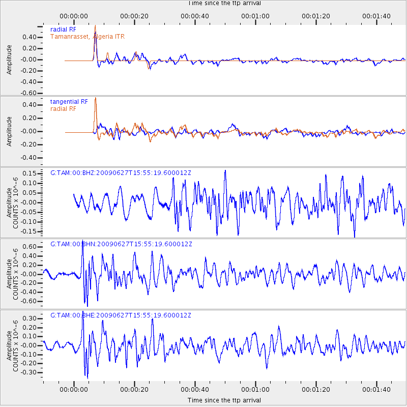
TAM Tamanrasset, Algeria - Earthquake Result Viewer
*The percent match for this event was below the threshold and hence no stack was calculated.
| Earthquake location: |
Southern Mid-Atlantic Ridge |
| Earthquake latitude/longitude: |
-33.2/-15.9 |
| Earthquake time(UTC): |
2009/06/27 (178) 15:45:49 GMT |
| Earthquake Depth: |
13 km |
| Earthquake Magnitude: |
5.6 MB, 5.3 MS, 5.6 MW |
| Earthquake Catalog/Contributor: |
WHDF/NEIC |
|
| Network: |
G GEOSCOPE |
| Station: |
TAM Tamanrasset, Algeria |
| Lat/Lon: |
22.79 N/5.53 E |
| Elevation: |
1377 m |
|
| Distance: |
59.3 deg |
| Az: |
23.116 deg |
| Baz: |
200.896 deg |
| Ray Param: |
$rayparam |
*The percent match for this event was below the threshold and hence was not used in the summary stack. |
|
| Radial Match: |
78.89992 % |
| Radial Bump: |
400 |
| Transverse Match: |
63.01405 % |
| Transverse Bump: |
400 |
| SOD ConfigId: |
2648 |
| Insert Time: |
2010-02-27 00:36:03.794 +0000 |
| GWidth: |
2.5 |
| Max Bumps: |
400 |
| Tol: |
0.001 |
|
Signal To Noise
| Channel | StoN | STA | LTA |
| G:TAM:00:BHN:20090627T15:55:19.600012Z | 3.7791605 | 3.0068645E-7 | 7.956436E-8 |
| G:TAM:00:BHE:20090627T15:55:19.600012Z | 4.077093 | 1.6114531E-7 | 3.952456E-8 |
| G:TAM:00:BHZ:20090627T15:55:19.600012Z | 1.5031261 | 5.805454E-8 | 3.8622535E-8 |
| Arrivals |
| Ps | |
| PpPs | |
| PsPs/PpSs | |


