You are here: Home > Network List > G - GEOSCOPE Stations List
> Station TAM Tamanrasset, Algeria > Earthquake Result Viewer
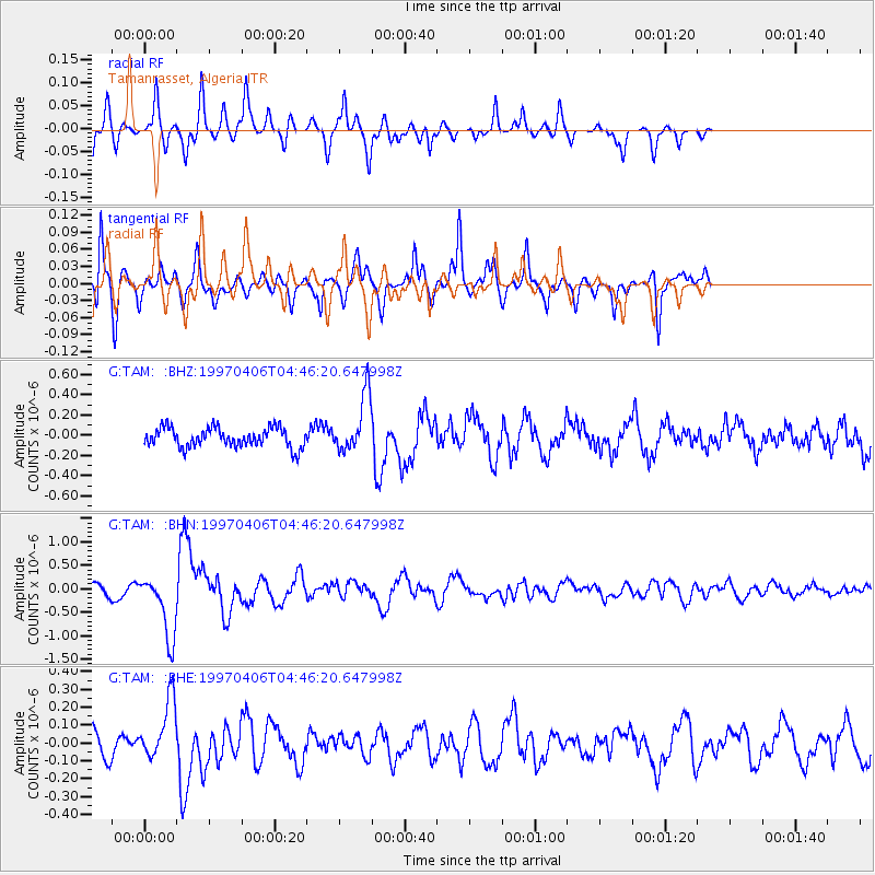
TAM Tamanrasset, Algeria - Earthquake Result Viewer
*The percent match for this event was below the threshold and hence no stack was calculated.
| Earthquake location: |
Southern Xinjiang, China |
| Earthquake latitude/longitude: |
39.5/77.0 |
| Earthquake time(UTC): |
1997/04/06 (096) 04:36:35 GMT |
| Earthquake Depth: |
33 km |
| Earthquake Magnitude: |
5.6 MB, 5.8 MS, 5.9 UNKNOWN, 5.9 MW |
| Earthquake Catalog/Contributor: |
WHDF/NEIC |
|
| Network: |
G GEOSCOPE |
| Station: |
TAM Tamanrasset, Algeria |
| Lat/Lon: |
22.79 N/5.53 E |
| Elevation: |
1377 m |
|
| Distance: |
61.9 deg |
| Az: |
277.288 deg |
| Baz: |
56.221 deg |
| Ray Param: |
$rayparam |
*The percent match for this event was below the threshold and hence was not used in the summary stack. |
|
| Radial Match: |
85.41986 % |
| Radial Bump: |
231 |
| Transverse Match: |
82.970665 % |
| Transverse Bump: |
309 |
| SOD ConfigId: |
4480 |
| Insert Time: |
2010-02-27 00:36:08.600 +0000 |
| GWidth: |
2.5 |
| Max Bumps: |
400 |
| Tol: |
0.001 |
|
Signal To Noise
| Channel | StoN | STA | LTA |
| G:TAM: :BHN:19970406T04:46:20.647998Z | 4.5536833 | 6.7074933E-7 | 1.4729821E-7 |
| G:TAM: :BHE:19970406T04:46:20.647998Z | 2.592633 | 1.6686458E-7 | 6.4361046E-8 |
| G:TAM: :BHZ:19970406T04:46:20.647998Z | 2.9304817 | 2.8433095E-7 | 9.702533E-8 |
| Arrivals |
| Ps | |
| PpPs | |
| PsPs/PpSs | |


