You are here: Home > Network List > G - GEOSCOPE Stations List
> Station TAM Tamanrasset, Algeria > Earthquake Result Viewer
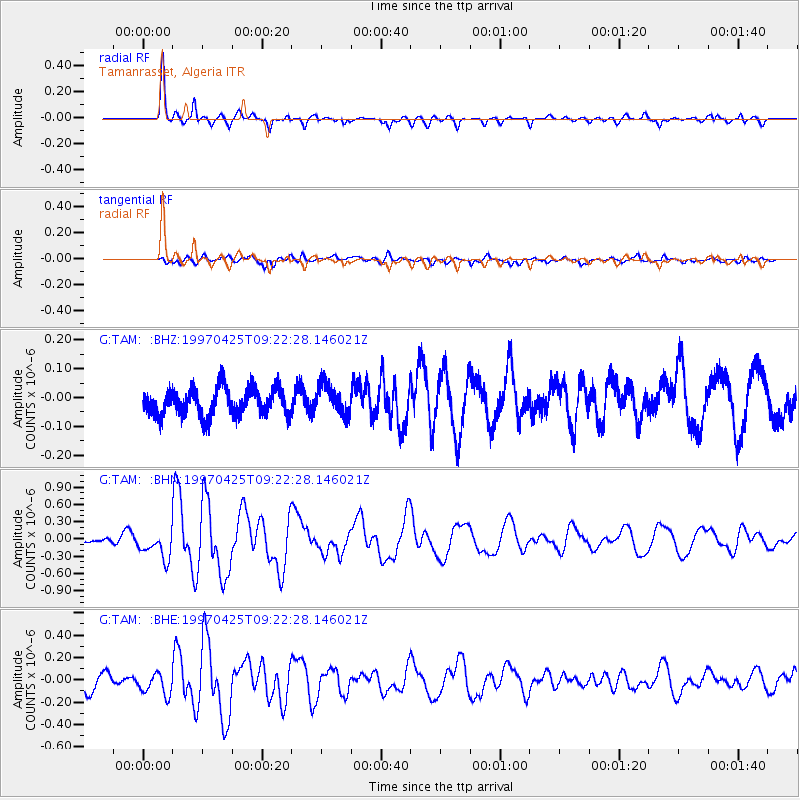
TAM Tamanrasset, Algeria - Earthquake Result Viewer
*The percent match for this event was below the threshold and hence no stack was calculated.
| Earthquake location: |
Southern Mid-Atlantic Ridge |
| Earthquake latitude/longitude: |
-48.3/-10.0 |
| Earthquake time(UTC): |
1997/04/25 (115) 09:11:34 GMT |
| Earthquake Depth: |
10 km |
| Earthquake Magnitude: |
5.8 MS, 5.3 MB, 5.8 UNKNOWN, 5.7 MW |
| Earthquake Catalog/Contributor: |
WHDF/NEIC |
|
| Network: |
G GEOSCOPE |
| Station: |
TAM Tamanrasset, Algeria |
| Lat/Lon: |
22.79 N/5.53 E |
| Elevation: |
1377 m |
|
| Distance: |
72.2 deg |
| Az: |
15.079 deg |
| Baz: |
190.841 deg |
| Ray Param: |
$rayparam |
*The percent match for this event was below the threshold and hence was not used in the summary stack. |
|
| Radial Match: |
87.06018 % |
| Radial Bump: |
319 |
| Transverse Match: |
62.835922 % |
| Transverse Bump: |
400 |
| SOD ConfigId: |
4480 |
| Insert Time: |
2010-02-27 00:36:14.955 +0000 |
| GWidth: |
2.5 |
| Max Bumps: |
400 |
| Tol: |
0.001 |
|
Signal To Noise
| Channel | StoN | STA | LTA |
| G:TAM: :BHN:19970425T09:22:28.146021Z | 3.8787334 | 2.4607905E-7 | 6.3443146E-8 |
| G:TAM: :BHE:19970425T09:22:28.146021Z | 1.6729604 | 1.0085474E-7 | 6.0285196E-8 |
| G:TAM: :BHZ:19970425T09:22:28.146021Z | 1.0877562 | 5.2272078E-8 | 4.8054957E-8 |
| Arrivals |
| Ps | |
| PpPs | |
| PsPs/PpSs | |


