You are here: Home > Network List > G - GEOSCOPE Stations List
> Station TAM Tamanrasset, Algeria > Earthquake Result Viewer
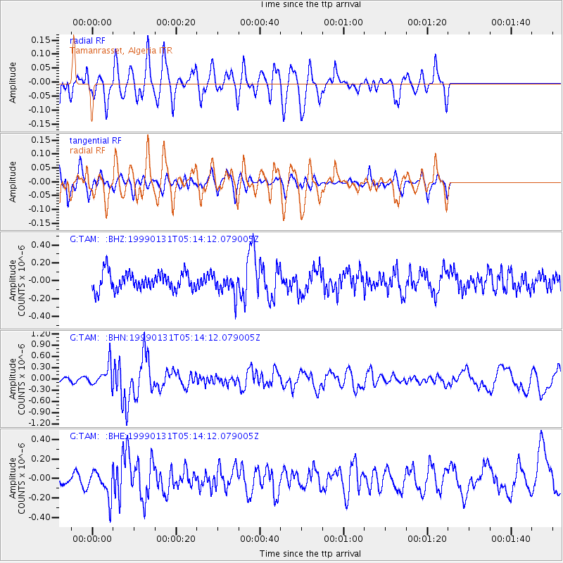
TAM Tamanrasset, Algeria - Earthquake Result Viewer
*The percent match for this event was below the threshold and hence no stack was calculated.
| Earthquake location: |
Eastern Caucasus |
| Earthquake latitude/longitude: |
43.2/46.8 |
| Earthquake time(UTC): |
1999/01/31 (031) 05:07:13 GMT |
| Earthquake Depth: |
33 km |
| Earthquake Magnitude: |
5.8 MW, 5.4 MS, 5.3 MB, 5.7 MW |
| Earthquake Catalog/Contributor: |
WHDF/NEIC |
|
| Network: |
G GEOSCOPE |
| Station: |
TAM Tamanrasset, Algeria |
| Lat/Lon: |
22.79 N/5.53 E |
| Elevation: |
1377 m |
|
| Distance: |
39.7 deg |
| Az: |
252.631 deg |
| Baz: |
49.182 deg |
| Ray Param: |
$rayparam |
*The percent match for this event was below the threshold and hence was not used in the summary stack. |
|
| Radial Match: |
81.62568 % |
| Radial Bump: |
400 |
| Transverse Match: |
56.399128 % |
| Transverse Bump: |
400 |
| SOD ConfigId: |
4480 |
| Insert Time: |
2010-02-27 00:36:15.583 +0000 |
| GWidth: |
2.5 |
| Max Bumps: |
400 |
| Tol: |
0.001 |
|
Signal To Noise
| Channel | StoN | STA | LTA |
| G:TAM: :BHN:19990131T05:14:12.079005Z | 3.7635753 | 2.9113698E-7 | 7.7356496E-8 |
| G:TAM: :BHE:19990131T05:14:12.079005Z | 2.8304417 | 1.4037568E-7 | 4.959497E-8 |
| G:TAM: :BHZ:19990131T05:14:12.079005Z | 1.2344134 | 1.2018033E-7 | 9.735826E-8 |
| Arrivals |
| Ps | |
| PpPs | |
| PsPs/PpSs | |


