You are here: Home > Network List > TA - USArray Transportable Network (new EarthScope stations) Stations List
> Station G43A Wallace, MI, USA > Earthquake Result Viewer
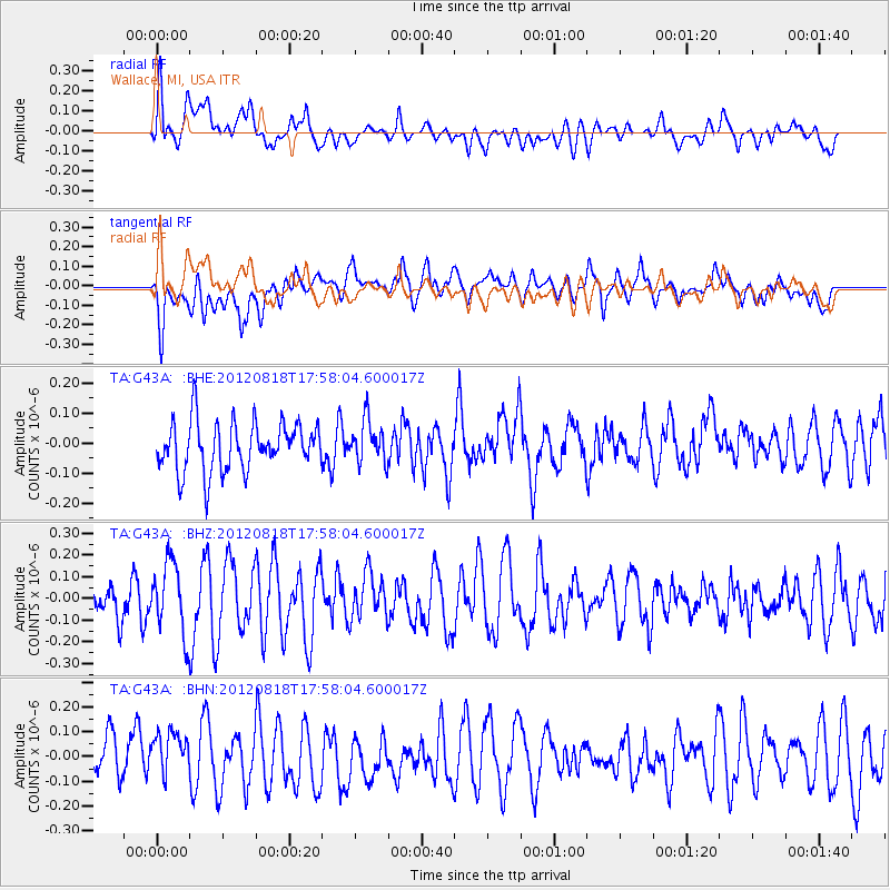
G43A Wallace, MI, USA - Earthquake Result Viewer
*The percent match for this event was below the threshold and hence no stack was calculated.
| Earthquake location: |
Tonga Islands |
| Earthquake latitude/longitude: |
-15.6/-173.0 |
| Earthquake time(UTC): |
2012/08/18 (231) 17:45:02 GMT |
| Earthquake Depth: |
15 km |
| Earthquake Magnitude: |
5.7 MW, 5.4 MS, 5.4 MB, 5.7 MW |
| Earthquake Catalog/Contributor: |
WHDF/NEIC |
|
| Network: |
TA USArray Transportable Network (new EarthScope stations) |
| Station: |
G43A Wallace, MI, USA |
| Lat/Lon: |
45.26 N/87.69 W |
| Elevation: |
213 m |
|
| Distance: |
97.7 deg |
| Az: |
45.267 deg |
| Baz: |
255.748 deg |
| Ray Param: |
$rayparam |
*The percent match for this event was below the threshold and hence was not used in the summary stack. |
|
| Radial Match: |
64.973854 % |
| Radial Bump: |
400 |
| Transverse Match: |
49.991257 % |
| Transverse Bump: |
400 |
| SOD ConfigId: |
469095 |
| Insert Time: |
2013-02-22 07:17:56.589 +0000 |
| GWidth: |
2.5 |
| Max Bumps: |
400 |
| Tol: |
0.001 |
|
Signal To Noise
| Channel | StoN | STA | LTA |
| TA:G43A: :BHZ:20120818T17:58:04.600017Z | 1.592891 | 1.6365502E-7 | 1.0274088E-7 |
| TA:G43A: :BHN:20120818T17:58:04.600017Z | 1.3622174 | 1.0484705E-7 | 7.696792E-8 |
| TA:G43A: :BHE:20120818T17:58:04.600017Z | 0.8780225 | 7.1067895E-8 | 8.0940865E-8 |
| Arrivals |
| Ps | |
| PpPs | |
| PsPs/PpSs | |


