You are here: Home > Network List > G - GEOSCOPE Stations List
> Station TAM Tamanrasset, Algeria > Earthquake Result Viewer
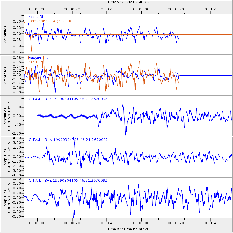
TAM Tamanrasset, Algeria - Earthquake Result Viewer
*The percent match for this event was below the threshold and hence no stack was calculated.
| Earthquake location: |
Southern Iran |
| Earthquake latitude/longitude: |
28.3/57.2 |
| Earthquake time(UTC): |
1999/03/04 (063) 05:38:26 GMT |
| Earthquake Depth: |
33 km |
| Earthquake Magnitude: |
6.2 MB, 6.5 MS, 6.6 MW, 6.4 MW |
| Earthquake Catalog/Contributor: |
WHDF/NEIC |
|
| Network: |
G GEOSCOPE |
| Station: |
TAM Tamanrasset, Algeria |
| Lat/Lon: |
22.79 N/5.53 E |
| Elevation: |
1377 m |
|
| Distance: |
46.7 deg |
| Az: |
275.458 deg |
| Baz: |
71.954 deg |
| Ray Param: |
$rayparam |
*The percent match for this event was below the threshold and hence was not used in the summary stack. |
|
| Radial Match: |
93.75723 % |
| Radial Bump: |
400 |
| Transverse Match: |
65.846695 % |
| Transverse Bump: |
400 |
| SOD ConfigId: |
4480 |
| Insert Time: |
2010-02-27 00:36:22.123 +0000 |
| GWidth: |
2.5 |
| Max Bumps: |
400 |
| Tol: |
0.001 |
|
Signal To Noise
| Channel | StoN | STA | LTA |
| G:TAM: :BHN:19990304T05:46:21.267009Z | 2.576091 | 3.1540944E-7 | 1.2243721E-7 |
| G:TAM: :BHE:19990304T05:46:21.267009Z | 1.2416869 | 1.1216603E-7 | 9.0333586E-8 |
| G:TAM: :BHZ:19990304T05:46:21.267009Z | 1.3743569 | 1.2787346E-7 | 9.304241E-8 |
| Arrivals |
| Ps | |
| PpPs | |
| PsPs/PpSs | |


