You are here: Home > Network List > G - GEOSCOPE Stations List
> Station TAM Tamanrasset, Algeria > Earthquake Result Viewer
TAM Tamanrasset, Algeria - Earthquake Result Viewer
*The percent match for this event was below the threshold and hence no stack was calculated.
| Earthquake location: |
Near Coast Of Peru |
| Earthquake latitude/longitude: |
-11.3/-77.8 |
| Earthquake time(UTC): |
1991/04/29 (119) 18:12:22 GMT |
| Earthquake Depth: |
57 km |
| Earthquake Magnitude: |
5.6 MB |
| Earthquake Catalog/Contributor: |
WHDF/NEIC |
|
| Network: |
G GEOSCOPE |
| Station: |
TAM Tamanrasset, Algeria |
| Lat/Lon: |
22.79 N/5.53 E |
| Elevation: |
1377 m |
|
| Distance: |
88.2 deg |
| Az: |
66.483 deg |
| Baz: |
257.05 deg |
| Ray Param: |
$rayparam |
*The percent match for this event was below the threshold and hence was not used in the summary stack. |
|
| Radial Match: |
76.028465 % |
| Radial Bump: |
302 |
| Transverse Match: |
69.24468 % |
| Transverse Bump: |
400 |
| SOD ConfigId: |
4480 |
| Insert Time: |
2010-02-27 00:36:32.030 +0000 |
| GWidth: |
2.5 |
| Max Bumps: |
400 |
| Tol: |
0.001 |
|
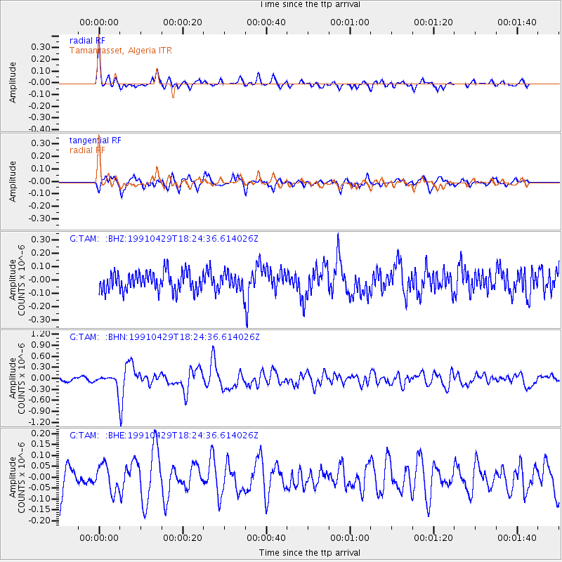
Signal To Noise
| Channel | StoN | STA | LTA |
| G:TAM: :BHN:19910429T18:24:36.614026Z | 3.2446551 | 1.9440576E-7 | 5.991569E-8 |
| G:TAM: :BHE:19910429T18:24:36.614026Z | 1.0813638 | 6.158524E-8 | 5.695145E-8 |
| G:TAM: :BHZ:19910429T18:24:36.614026Z | 0.98246115 | 6.771437E-8 | 6.892321E-8 |
| Arrivals |
| Ps | |
| PpPs | |
| PsPs/PpSs | |


