You are here: Home > Network List > TA - USArray Transportable Network (new EarthScope stations) Stations List
> Station Z45A Winona, MS, USA > Earthquake Result Viewer
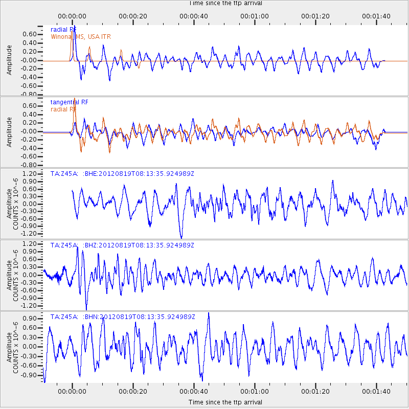
Z45A Winona, MS, USA - Earthquake Result Viewer
*The percent match for this event was below the threshold and hence no stack was calculated.
| Earthquake location: |
Off Coast Of Washington |
| Earthquake latitude/longitude: |
47.8/-128.6 |
| Earthquake time(UTC): |
2012/08/19 (232) 08:07:35 GMT |
| Earthquake Depth: |
10 km |
| Earthquake Magnitude: |
5.6 MW, 5.3 MS, 5.2 MB, 5.5 MW |
| Earthquake Catalog/Contributor: |
WHDF/NEIC |
|
| Network: |
TA USArray Transportable Network (new EarthScope stations) |
| Station: |
Z45A Winona, MS, USA |
| Lat/Lon: |
33.37 N/89.69 W |
| Elevation: |
113 m |
|
| Distance: |
32.5 deg |
| Az: |
101.976 deg |
| Baz: |
307.974 deg |
| Ray Param: |
$rayparam |
*The percent match for this event was below the threshold and hence was not used in the summary stack. |
|
| Radial Match: |
63.11875 % |
| Radial Bump: |
400 |
| Transverse Match: |
61.85493 % |
| Transverse Bump: |
400 |
| SOD ConfigId: |
469095 |
| Insert Time: |
2013-02-22 07:28:19.514 +0000 |
| GWidth: |
2.5 |
| Max Bumps: |
400 |
| Tol: |
0.001 |
|
Signal To Noise
| Channel | StoN | STA | LTA |
| TA:Z45A: :BHZ:20120819T08:13:35.924989Z | 5.4331417 | 6.088146E-7 | 1.1205573E-7 |
| TA:Z45A: :BHN:20120819T08:13:35.924989Z | 0.85499966 | 4.1457855E-7 | 4.848874E-7 |
| TA:Z45A: :BHE:20120819T08:13:35.924989Z | 1.0683844 | 3.2123418E-7 | 3.0067287E-7 |
| Arrivals |
| Ps | |
| PpPs | |
| PsPs/PpSs | |


