You are here: Home > Network List > TA - USArray Transportable Network (new EarthScope stations) Stations List
> Station Y41A Eaglette Bearden, AR, USA > Earthquake Result Viewer
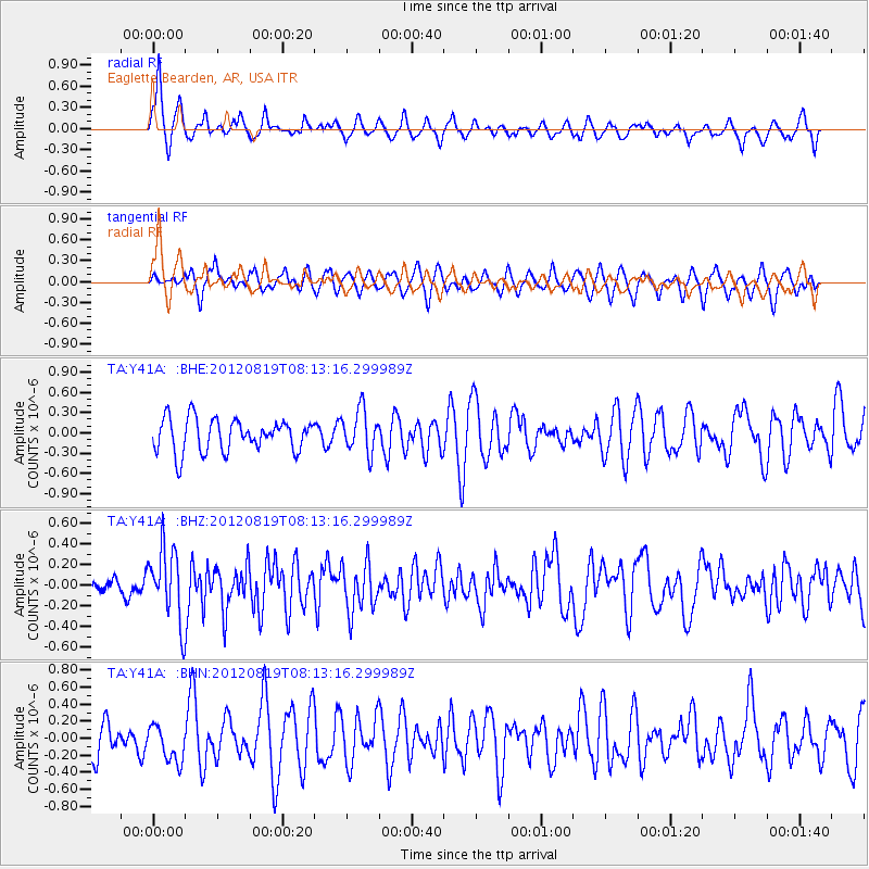
Y41A Eaglette Bearden, AR, USA - Earthquake Result Viewer
*The percent match for this event was below the threshold and hence no stack was calculated.
| Earthquake location: |
Off Coast Of Washington |
| Earthquake latitude/longitude: |
47.8/-128.6 |
| Earthquake time(UTC): |
2012/08/19 (232) 08:07:35 GMT |
| Earthquake Depth: |
10 km |
| Earthquake Magnitude: |
5.6 MW, 5.3 MS, 5.2 MB, 5.5 MW |
| Earthquake Catalog/Contributor: |
WHDF/NEIC |
|
| Network: |
TA USArray Transportable Network (new EarthScope stations) |
| Station: |
Y41A Eaglette Bearden, AR, USA |
| Lat/Lon: |
33.88 N/92.61 W |
| Elevation: |
99 m |
|
| Distance: |
30.3 deg |
| Az: |
104.091 deg |
| Baz: |
308.17 deg |
| Ray Param: |
$rayparam |
*The percent match for this event was below the threshold and hence was not used in the summary stack. |
|
| Radial Match: |
59.92273 % |
| Radial Bump: |
359 |
| Transverse Match: |
52.96485 % |
| Transverse Bump: |
400 |
| SOD ConfigId: |
469095 |
| Insert Time: |
2013-02-22 07:28:29.703 +0000 |
| GWidth: |
2.5 |
| Max Bumps: |
400 |
| Tol: |
0.001 |
|
Signal To Noise
| Channel | StoN | STA | LTA |
| TA:Y41A: :BHZ:20120819T08:13:16.299989Z | 4.580097 | 3.519001E-7 | 7.683246E-8 |
| TA:Y41A: :BHN:20120819T08:13:16.299989Z | 1.0014157 | 2.1293249E-7 | 2.1263146E-7 |
| TA:Y41A: :BHE:20120819T08:13:16.299989Z | 1.3200337 | 3.1881308E-7 | 2.415189E-7 |
| Arrivals |
| Ps | |
| PpPs | |
| PsPs/PpSs | |


