You are here: Home > Network List > TA - USArray Transportable Network (new EarthScope stations) Stations List
> Station W43A Forest City, AR, USA > Earthquake Result Viewer
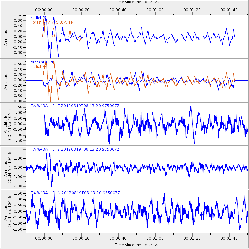
W43A Forest City, AR, USA - Earthquake Result Viewer
*The percent match for this event was below the threshold and hence no stack was calculated.
| Earthquake location: |
Off Coast Of Washington |
| Earthquake latitude/longitude: |
47.8/-128.6 |
| Earthquake time(UTC): |
2012/08/19 (232) 08:07:35 GMT |
| Earthquake Depth: |
10 km |
| Earthquake Magnitude: |
5.6 MW, 5.3 MS, 5.2 MB, 5.5 MW |
| Earthquake Catalog/Contributor: |
WHDF/NEIC |
|
| Network: |
TA USArray Transportable Network (new EarthScope stations) |
| Station: |
W43A Forest City, AR, USA |
| Lat/Lon: |
35.09 N/90.71 W |
| Elevation: |
70 m |
|
| Distance: |
30.8 deg |
| Az: |
100.333 deg |
| Baz: |
306.007 deg |
| Ray Param: |
$rayparam |
*The percent match for this event was below the threshold and hence was not used in the summary stack. |
|
| Radial Match: |
76.53328 % |
| Radial Bump: |
335 |
| Transverse Match: |
50.64531 % |
| Transverse Bump: |
330 |
| SOD ConfigId: |
469095 |
| Insert Time: |
2013-02-22 07:29:48.506 +0000 |
| GWidth: |
2.5 |
| Max Bumps: |
400 |
| Tol: |
0.001 |
|
Signal To Noise
| Channel | StoN | STA | LTA |
| TA:W43A: :BHZ:20120819T08:13:20.975007Z | 4.5841155 | 9.509349E-7 | 2.0744132E-7 |
| TA:W43A: :BHN:20120819T08:13:20.975007Z | 1.0925583 | 4.7434563E-7 | 4.3416048E-7 |
| TA:W43A: :BHE:20120819T08:13:20.975007Z | 1.0421945 | 5.570158E-7 | 5.3446433E-7 |
| Arrivals |
| Ps | |
| PpPs | |
| PsPs/PpSs | |


