You are here: Home > Network List > TA - USArray Transportable Network (new EarthScope stations) Stations List
> Station 657A Interlachen, FL, USA > Earthquake Result Viewer
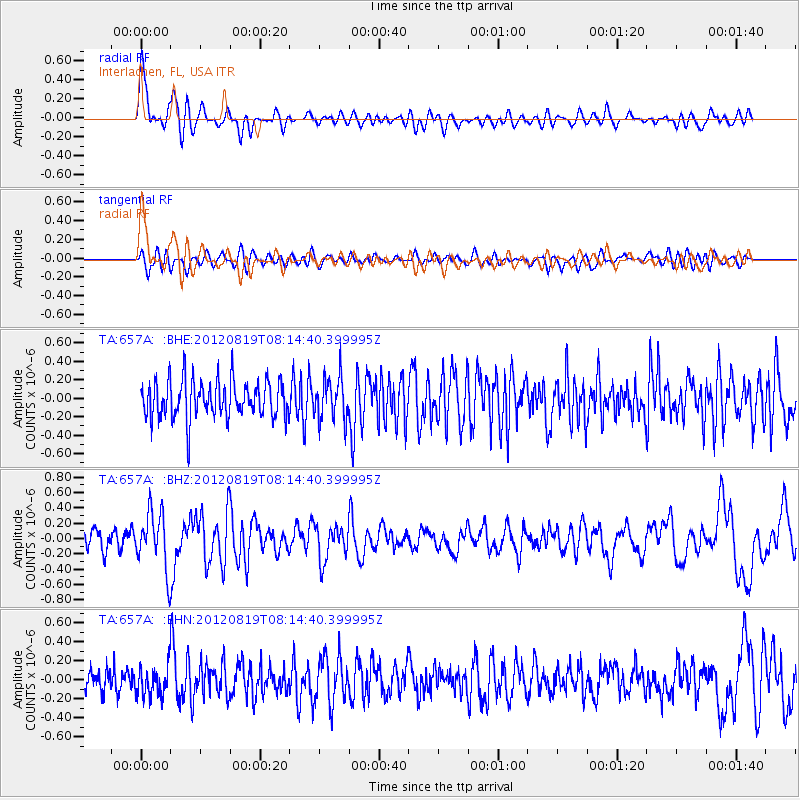
657A Interlachen, FL, USA - Earthquake Result Viewer
*The percent match for this event was below the threshold and hence no stack was calculated.
| Earthquake location: |
Off Coast Of Washington |
| Earthquake latitude/longitude: |
47.8/-128.6 |
| Earthquake time(UTC): |
2012/08/19 (232) 08:07:35 GMT |
| Earthquake Depth: |
10 km |
| Earthquake Magnitude: |
5.6 MW, 5.3 MS, 5.2 MB, 5.5 MW |
| Earthquake Catalog/Contributor: |
WHDF/NEIC |
|
| Network: |
TA USArray Transportable Network (new EarthScope stations) |
| Station: |
657A Interlachen, FL, USA |
| Lat/Lon: |
29.59 N/81.87 W |
| Elevation: |
34 m |
|
| Distance: |
40.1 deg |
| Az: |
99.787 deg |
| Baz: |
310.279 deg |
| Ray Param: |
$rayparam |
*The percent match for this event was below the threshold and hence was not used in the summary stack. |
|
| Radial Match: |
74.1533 % |
| Radial Bump: |
400 |
| Transverse Match: |
55.56172 % |
| Transverse Bump: |
400 |
| SOD ConfigId: |
469095 |
| Insert Time: |
2013-02-22 07:35:02.051 +0000 |
| GWidth: |
2.5 |
| Max Bumps: |
400 |
| Tol: |
0.001 |
|
Signal To Noise
| Channel | StoN | STA | LTA |
| TA:657A: :BHZ:20120819T08:14:40.399995Z | 3.380059 | 3.686146E-7 | 1.0905567E-7 |
| TA:657A: :BHN:20120819T08:14:40.399995Z | 1.1337446 | 1.5548484E-7 | 1.3714273E-7 |
| TA:657A: :BHE:20120819T08:14:40.399995Z | 1.121326 | 2.2877394E-7 | 2.040209E-7 |
| Arrivals |
| Ps | |
| PpPs | |
| PsPs/PpSs | |


