You are here: Home > Network List > TA - USArray Transportable Network (new EarthScope stations) Stations List
> Station T52A Hallie, KY, USA > Earthquake Result Viewer
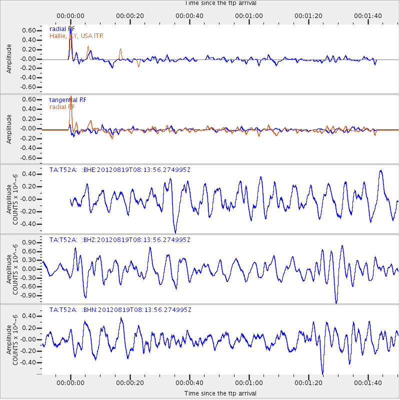
T52A Hallie, KY, USA - Earthquake Result Viewer
*The percent match for this event was below the threshold and hence no stack was calculated.
| Earthquake location: |
Off Coast Of Washington |
| Earthquake latitude/longitude: |
47.8/-128.6 |
| Earthquake time(UTC): |
2012/08/19 (232) 08:07:35 GMT |
| Earthquake Depth: |
10 km |
| Earthquake Magnitude: |
5.6 MW, 5.3 MS, 5.2 MB, 5.5 MW |
| Earthquake Catalog/Contributor: |
WHDF/NEIC |
|
| Network: |
TA USArray Transportable Network (new EarthScope stations) |
| Station: |
T52A Hallie, KY, USA |
| Lat/Lon: |
37.11 N/82.99 W |
| Elevation: |
436 m |
|
| Distance: |
34.9 deg |
| Az: |
90.771 deg |
| Baz: |
302.496 deg |
| Ray Param: |
$rayparam |
*The percent match for this event was below the threshold and hence was not used in the summary stack. |
|
| Radial Match: |
74.6887 % |
| Radial Bump: |
396 |
| Transverse Match: |
62.171257 % |
| Transverse Bump: |
400 |
| SOD ConfigId: |
469095 |
| Insert Time: |
2013-02-22 07:38:38.724 +0000 |
| GWidth: |
2.5 |
| Max Bumps: |
400 |
| Tol: |
0.001 |
|
Signal To Noise
| Channel | StoN | STA | LTA |
| TA:T52A: :BHZ:20120819T08:13:56.274995Z | 2.4007087 | 4.1603886E-7 | 1.7329836E-7 |
| TA:T52A: :BHN:20120819T08:13:56.274995Z | 1.6823078 | 1.6571991E-7 | 9.8507485E-8 |
| TA:T52A: :BHE:20120819T08:13:56.274995Z | 1.9902401 | 2.0845596E-7 | 1.04739094E-7 |
| Arrivals |
| Ps | |
| PpPs | |
| PsPs/PpSs | |


