You are here: Home > Network List > G - GEOSCOPE Stations List
> Station TAM Tamanrasset, Algeria > Earthquake Result Viewer
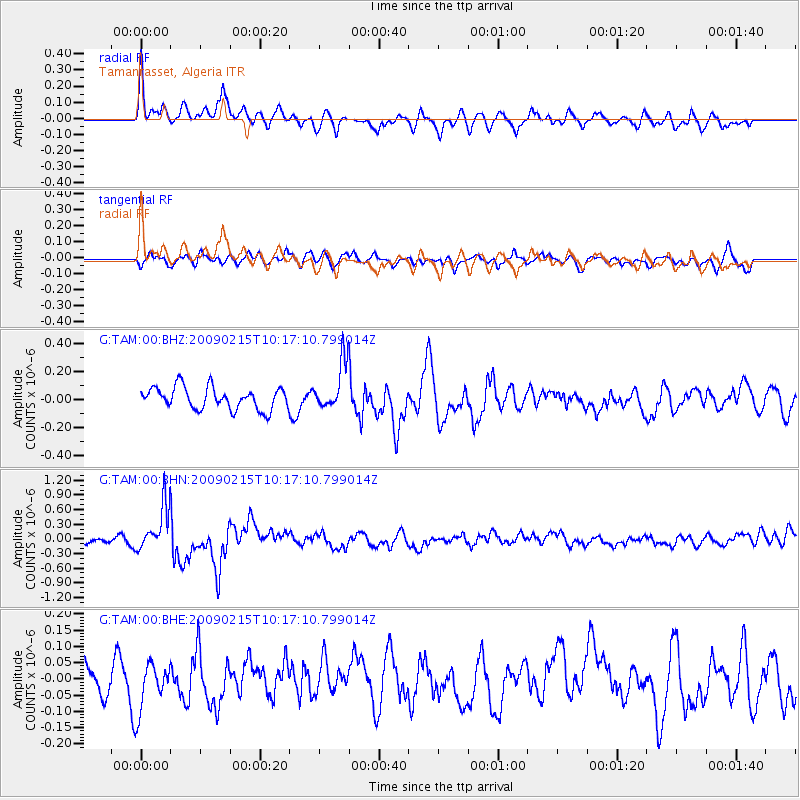
TAM Tamanrasset, Algeria - Earthquake Result Viewer
*The percent match for this event was below the threshold and hence no stack was calculated.
| Earthquake location: |
Near Coast Of Northern Peru |
| Earthquake latitude/longitude: |
-5.9/-80.9 |
| Earthquake time(UTC): |
2009/02/15 (046) 10:04:49 GMT |
| Earthquake Depth: |
21 km |
| Earthquake Magnitude: |
5.8 MB, 5.7 MS, 6.1 MW, 6.1 MW |
| Earthquake Catalog/Contributor: |
WHDF/NEIC |
|
| Network: |
G GEOSCOPE |
| Station: |
TAM Tamanrasset, Algeria |
| Lat/Lon: |
22.79 N/5.53 E |
| Elevation: |
1377 m |
|
| Distance: |
88.9 deg |
| Az: |
67.102 deg |
| Baz: |
263.254 deg |
| Ray Param: |
$rayparam |
*The percent match for this event was below the threshold and hence was not used in the summary stack. |
|
| Radial Match: |
74.67335 % |
| Radial Bump: |
400 |
| Transverse Match: |
60.3178 % |
| Transverse Bump: |
400 |
| SOD ConfigId: |
2658 |
| Insert Time: |
2010-02-27 00:36:53.941 +0000 |
| GWidth: |
2.5 |
| Max Bumps: |
400 |
| Tol: |
0.001 |
|
Signal To Noise
| Channel | StoN | STA | LTA |
| G:TAM:00:BHN:20090215T10:17:10.799014Z | 6.768034 | 4.5949116E-7 | 6.7891385E-8 |
| G:TAM:00:BHE:20090215T10:17:10.799014Z | 1.2072616 | 7.13451E-8 | 5.909664E-8 |
| G:TAM:00:BHZ:20090215T10:17:10.799014Z | 2.1558588 | 1.6809257E-7 | 7.797012E-8 |
| Arrivals |
| Ps | |
| PpPs | |
| PsPs/PpSs | |


