You are here: Home > Network List > CI - Caltech Regional Seismic Network Stations List
> Station SMM Simmler, CA, USA > Earthquake Result Viewer
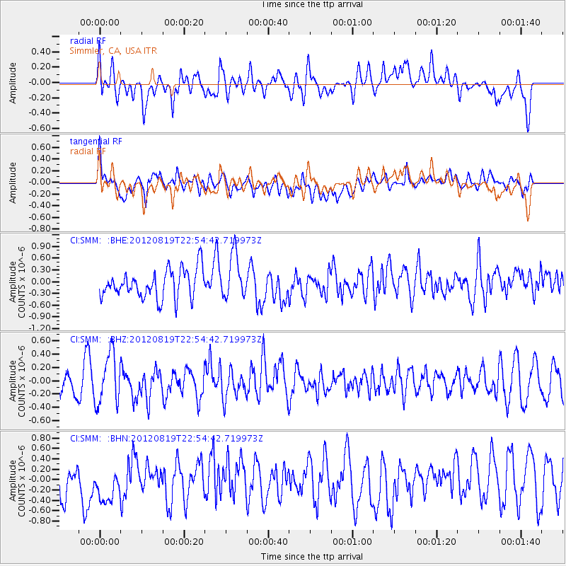
SMM Simmler, CA, USA - Earthquake Result Viewer
*The percent match for this event was below the threshold and hence no stack was calculated.
| Earthquake location: |
Near N Coast Of New Guinea, P.N.G. |
| Earthquake latitude/longitude: |
-4.8/144.6 |
| Earthquake time(UTC): |
2012/08/19 (232) 22:41:49 GMT |
| Earthquake Depth: |
73 km |
| Earthquake Magnitude: |
6.0 MB, 6.2 MW, 6.3 MW |
| Earthquake Catalog/Contributor: |
WHDF/NEIC |
|
| Network: |
CI Caltech Regional Seismic Network |
| Station: |
SMM Simmler, CA, USA |
| Lat/Lon: |
35.31 N/120.00 W |
| Elevation: |
599 m |
|
| Distance: |
97.2 deg |
| Az: |
55.14 deg |
| Baz: |
269.239 deg |
| Ray Param: |
$rayparam |
*The percent match for this event was below the threshold and hence was not used in the summary stack. |
|
| Radial Match: |
53.805893 % |
| Radial Bump: |
400 |
| Transverse Match: |
48.646194 % |
| Transverse Bump: |
400 |
| SOD ConfigId: |
469095 |
| Insert Time: |
2013-02-22 07:45:31.595 +0000 |
| GWidth: |
2.5 |
| Max Bumps: |
400 |
| Tol: |
0.001 |
|
Signal To Noise
| Channel | StoN | STA | LTA |
| CI:SMM: :BHZ:20120819T22:54:42.719973Z | 1.9091097 | 3.8337166E-7 | 2.0081175E-7 |
| CI:SMM: :BHN:20120819T22:54:42.719973Z | 1.2041647 | 4.3922174E-7 | 3.6475222E-7 |
| CI:SMM: :BHE:20120819T22:54:42.719973Z | 1.5882765 | 5.7351235E-7 | 3.6109103E-7 |
| Arrivals |
| Ps | |
| PpPs | |
| PsPs/PpSs | |


