You are here: Home > Network List > UW - Pacific Northwest Regional Seismic Network Stations List
> Station HOOD Mt Hood Meadows, OR CREST BB SMO > Earthquake Result Viewer
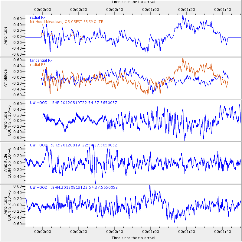
HOOD Mt Hood Meadows, OR CREST BB SMO - Earthquake Result Viewer
*The percent match for this event was below the threshold and hence no stack was calculated.
| Earthquake location: |
Near N Coast Of New Guinea, P.N.G. |
| Earthquake latitude/longitude: |
-4.8/144.6 |
| Earthquake time(UTC): |
2012/08/19 (232) 22:41:49 GMT |
| Earthquake Depth: |
73 km |
| Earthquake Magnitude: |
6.0 MB, 6.2 MW, 6.3 MW |
| Earthquake Catalog/Contributor: |
WHDF/NEIC |
|
| Network: |
UW Pacific Northwest Regional Seismic Network |
| Station: |
HOOD Mt Hood Meadows, OR CREST BB SMO |
| Lat/Lon: |
45.32 N/121.65 W |
| Elevation: |
1520 m |
|
| Distance: |
96.0 deg |
| Az: |
45.063 deg |
| Baz: |
269.325 deg |
| Ray Param: |
$rayparam |
*The percent match for this event was below the threshold and hence was not used in the summary stack. |
|
| Radial Match: |
69.09617 % |
| Radial Bump: |
400 |
| Transverse Match: |
62.48051 % |
| Transverse Bump: |
400 |
| SOD ConfigId: |
469095 |
| Insert Time: |
2013-02-22 07:48:46.266 +0000 |
| GWidth: |
2.5 |
| Max Bumps: |
400 |
| Tol: |
0.001 |
|
Signal To Noise
| Channel | StoN | STA | LTA |
| UW:HOOD: :BHZ:20120819T22:54:37.565005Z | 3.201387 | 2.6196176E-7 | 8.182759E-8 |
| UW:HOOD: :BHN:20120819T22:54:37.565005Z | 0.49517933 | 5.465103E-8 | 1.1036614E-7 |
| UW:HOOD: :BHE:20120819T22:54:37.565005Z | 0.7133839 | 9.665613E-8 | 1.3548964E-7 |
| Arrivals |
| Ps | |
| PpPs | |
| PsPs/PpSs | |


