You are here: Home > Network List > G - GEOSCOPE Stations List
> Station TAM Tamanrasset, Algeria > Earthquake Result Viewer
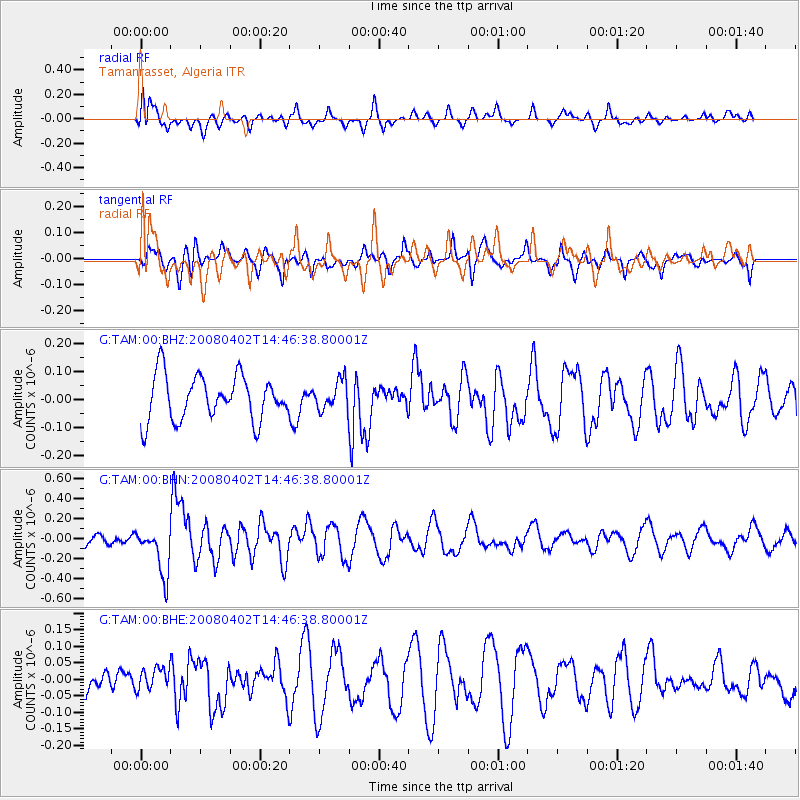
TAM Tamanrasset, Algeria - Earthquake Result Viewer
*The percent match for this event was below the threshold and hence no stack was calculated.
| Earthquake location: |
Chagos Archipelago Region |
| Earthquake latitude/longitude: |
-4.9/69.2 |
| Earthquake time(UTC): |
2008/04/02 (093) 14:36:10 GMT |
| Earthquake Depth: |
10 km |
| Earthquake Magnitude: |
5.5 MB, 5.3 MS, 5.7 MW, 5.7 MW |
| Earthquake Catalog/Contributor: |
WHDF/NEIC |
|
| Network: |
G GEOSCOPE |
| Station: |
TAM Tamanrasset, Algeria |
| Lat/Lon: |
22.79 N/5.53 E |
| Elevation: |
1377 m |
|
| Distance: |
68.0 deg |
| Az: |
296.82 deg |
| Baz: |
105.511 deg |
| Ray Param: |
$rayparam |
*The percent match for this event was below the threshold and hence was not used in the summary stack. |
|
| Radial Match: |
71.585846 % |
| Radial Bump: |
400 |
| Transverse Match: |
55.78458 % |
| Transverse Bump: |
400 |
| SOD ConfigId: |
2504 |
| Insert Time: |
2010-02-27 00:36:57.259 +0000 |
| GWidth: |
2.5 |
| Max Bumps: |
400 |
| Tol: |
0.001 |
|
Signal To Noise
| Channel | StoN | STA | LTA |
| G:TAM:00:BHN:20080402T14:46:38.80001Z | 3.4406433 | 2.3807407E-7 | 6.919464E-8 |
| G:TAM:00:BHE:20080402T14:46:38.80001Z | 0.7414674 | 3.3697663E-8 | 4.544726E-8 |
| G:TAM:00:BHZ:20080402T14:46:38.80001Z | 0.65378004 | 5.249008E-8 | 8.028706E-8 |
| Arrivals |
| Ps | |
| PpPs | |
| PsPs/PpSs | |


