You are here: Home > Network List > UW - Pacific Northwest Regional Seismic Network Stations List
> Station OMAK Colville Reservation, Omak, WA, USA > Earthquake Result Viewer
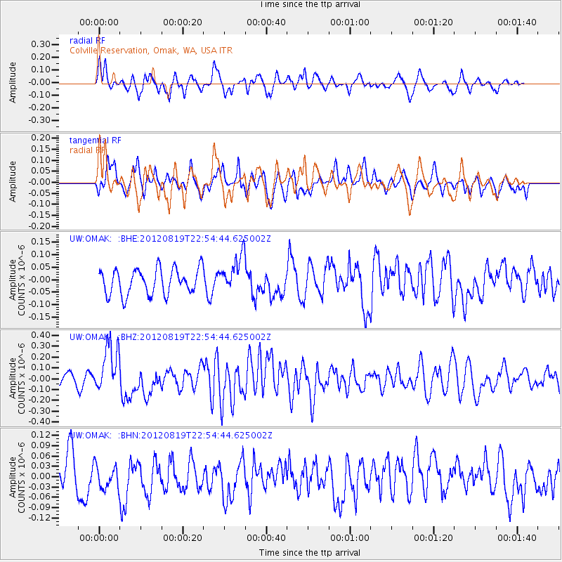
OMAK Colville Reservation, Omak, WA, USA - Earthquake Result Viewer
*The percent match for this event was below the threshold and hence no stack was calculated.
| Earthquake location: |
Near N Coast Of New Guinea, P.N.G. |
| Earthquake latitude/longitude: |
-4.8/144.6 |
| Earthquake time(UTC): |
2012/08/19 (232) 22:41:49 GMT |
| Earthquake Depth: |
73 km |
| Earthquake Magnitude: |
6.0 MB, 6.2 MW, 6.3 MW |
| Earthquake Catalog/Contributor: |
WHDF/NEIC |
|
| Network: |
UW Pacific Northwest Regional Seismic Network |
| Station: |
OMAK Colville Reservation, Omak, WA, USA |
| Lat/Lon: |
48.36 N/119.33 W |
| Elevation: |
696 m |
|
| Distance: |
97.6 deg |
| Az: |
41.994 deg |
| Baz: |
271.377 deg |
| Ray Param: |
$rayparam |
*The percent match for this event was below the threshold and hence was not used in the summary stack. |
|
| Radial Match: |
72.247505 % |
| Radial Bump: |
400 |
| Transverse Match: |
54.363857 % |
| Transverse Bump: |
399 |
| SOD ConfigId: |
469095 |
| Insert Time: |
2013-02-22 07:49:10.206 +0000 |
| GWidth: |
2.5 |
| Max Bumps: |
400 |
| Tol: |
0.001 |
|
Signal To Noise
| Channel | StoN | STA | LTA |
| UW:OMAK: :BHZ:20120819T22:54:44.625002Z | 5.9817452 | 2.2727103E-7 | 3.7994102E-8 |
| UW:OMAK: :BHN:20120819T22:54:44.625002Z | 0.90037173 | 4.153589E-8 | 4.6131937E-8 |
| UW:OMAK: :BHE:20120819T22:54:44.625002Z | 1.4593877 | 7.51821E-8 | 5.1516192E-8 |
| Arrivals |
| Ps | |
| PpPs | |
| PsPs/PpSs | |


