You are here: Home > Network List > G - GEOSCOPE Stations List
> Station TAM Tamanrasset, Algeria > Earthquake Result Viewer
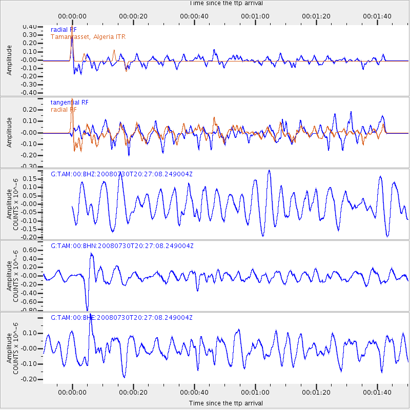
TAM Tamanrasset, Algeria - Earthquake Result Viewer
*The percent match for this event was below the threshold and hence no stack was calculated.
| Earthquake location: |
South Sandwich Islands Region |
| Earthquake latitude/longitude: |
-59.6/-27.8 |
| Earthquake time(UTC): |
2008/07/30 (212) 20:15:11 GMT |
| Earthquake Depth: |
136 km |
| Earthquake Magnitude: |
5.6 MB, 5.6 MW, 5.5 MW |
| Earthquake Catalog/Contributor: |
WHDF/NEIC |
|
| Network: |
G GEOSCOPE |
| Station: |
TAM Tamanrasset, Algeria |
| Lat/Lon: |
22.79 N/5.53 E |
| Elevation: |
1377 m |
|
| Distance: |
86.6 deg |
| Az: |
30.532 deg |
| Baz: |
196.236 deg |
| Ray Param: |
$rayparam |
*The percent match for this event was below the threshold and hence was not used in the summary stack. |
|
| Radial Match: |
59.72672 % |
| Radial Bump: |
368 |
| Transverse Match: |
61.955265 % |
| Transverse Bump: |
400 |
| SOD ConfigId: |
2504 |
| Insert Time: |
2010-02-27 00:37:02.779 +0000 |
| GWidth: |
2.5 |
| Max Bumps: |
400 |
| Tol: |
0.001 |
|
Signal To Noise
| Channel | StoN | STA | LTA |
| G:TAM:00:BHN:20080730T20:27:08.249004Z | 4.321333 | 2.3197202E-7 | 5.368066E-8 |
| G:TAM:00:BHE:20080730T20:27:08.249004Z | 1.9079813 | 8.6870955E-8 | 4.5530296E-8 |
| G:TAM:00:BHZ:20080730T20:27:08.249004Z | 0.7353694 | 6.452057E-8 | 8.773899E-8 |
| Arrivals |
| Ps | |
| PpPs | |
| PsPs/PpSs | |


