You are here: Home > Network List > TA - USArray Transportable Network (new EarthScope stations) Stations List
> Station M04C Macdoel, CA, USA > Earthquake Result Viewer
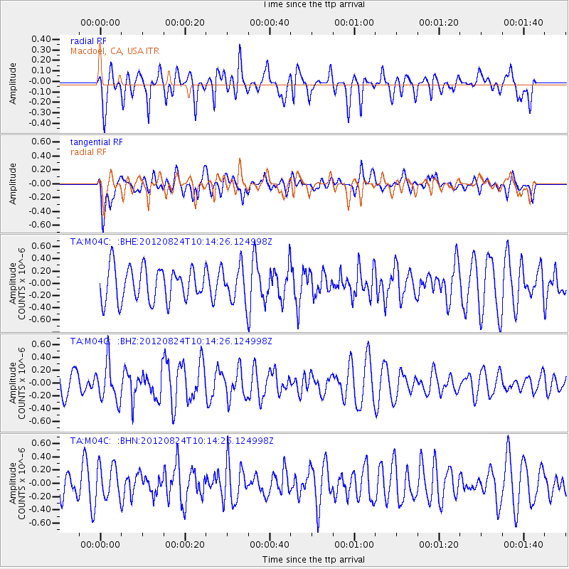
M04C Macdoel, CA, USA - Earthquake Result Viewer
*The percent match for this event was below the threshold and hence no stack was calculated.
| Earthquake location: |
South Of Kermadec Islands |
| Earthquake latitude/longitude: |
-33.4/-179.5 |
| Earthquake time(UTC): |
2012/08/24 (237) 10:01:53 GMT |
| Earthquake Depth: |
38 km |
| Earthquake Magnitude: |
5.6 MW, 5.1 MS, 5.2 MB, 5.8 MW |
| Earthquake Catalog/Contributor: |
WHDF/NEIC |
|
| Network: |
TA USArray Transportable Network (new EarthScope stations) |
| Station: |
M04C Macdoel, CA, USA |
| Lat/Lon: |
41.78 N/121.84 W |
| Elevation: |
1391 m |
|
| Distance: |
91.7 deg |
| Az: |
39.228 deg |
| Baz: |
224.998 deg |
| Ray Param: |
$rayparam |
*The percent match for this event was below the threshold and hence was not used in the summary stack. |
|
| Radial Match: |
54.916428 % |
| Radial Bump: |
400 |
| Transverse Match: |
40.42495 % |
| Transverse Bump: |
400 |
| SOD ConfigId: |
469095 |
| Insert Time: |
2013-02-22 08:05:01.885 +0000 |
| GWidth: |
2.5 |
| Max Bumps: |
400 |
| Tol: |
0.001 |
|
Signal To Noise
| Channel | StoN | STA | LTA |
| TA:M04C: :BHZ:20120824T10:14:26.124998Z | 1.8620211 | 3.0571607E-7 | 1.6418507E-7 |
| TA:M04C: :BHN:20120824T10:14:26.124998Z | 1.4864712 | 2.4933658E-7 | 1.6773726E-7 |
| TA:M04C: :BHE:20120824T10:14:26.124998Z | 1.0705608 | 2.9268193E-7 | 2.7339124E-7 |
| Arrivals |
| Ps | |
| PpPs | |
| PsPs/PpSs | |


