You are here: Home > Network List > UW - Pacific Northwest Regional Seismic Network Stations List
> Station LEBA Lebam, WA, USA > Earthquake Result Viewer
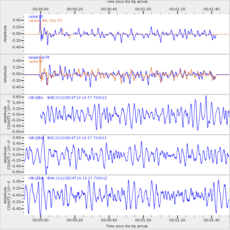
LEBA Lebam, WA, USA - Earthquake Result Viewer
*The percent match for this event was below the threshold and hence no stack was calculated.
| Earthquake location: |
South Of Kermadec Islands |
| Earthquake latitude/longitude: |
-33.4/-179.5 |
| Earthquake time(UTC): |
2012/08/24 (237) 10:01:53 GMT |
| Earthquake Depth: |
38 km |
| Earthquake Magnitude: |
5.6 MW, 5.1 MS, 5.2 MB, 5.8 MW |
| Earthquake Catalog/Contributor: |
WHDF/NEIC |
|
| Network: |
UW Pacific Northwest Regional Seismic Network |
| Station: |
LEBA Lebam, WA, USA |
| Lat/Lon: |
46.55 N/123.56 W |
| Elevation: |
73 m |
|
| Distance: |
94.2 deg |
| Az: |
34.999 deg |
| Baz: |
224.019 deg |
| Ray Param: |
$rayparam |
*The percent match for this event was below the threshold and hence was not used in the summary stack. |
|
| Radial Match: |
51.235126 % |
| Radial Bump: |
400 |
| Transverse Match: |
66.941765 % |
| Transverse Bump: |
400 |
| SOD ConfigId: |
469095 |
| Insert Time: |
2013-02-22 08:06:38.112 +0000 |
| GWidth: |
2.5 |
| Max Bumps: |
400 |
| Tol: |
0.001 |
|
Signal To Noise
| Channel | StoN | STA | LTA |
| UW:LEBA: :BHZ:20120824T10:14:37.70001Z | 2.8173442 | 3.7555617E-7 | 1.3330148E-7 |
| UW:LEBA: :BHN:20120824T10:14:37.70001Z | 1.7446643 | 3.2356166E-7 | 1.8545785E-7 |
| UW:LEBA: :BHE:20120824T10:14:37.70001Z | 1.6068338 | 2.4005274E-7 | 1.4939488E-7 |
| Arrivals |
| Ps | |
| PpPs | |
| PsPs/PpSs | |


