You are here: Home > Network List > TA - USArray Transportable Network (new EarthScope stations) Stations List
> Station N59A State Game Land 141, Hazleton, PA, USA > Earthquake Result Viewer
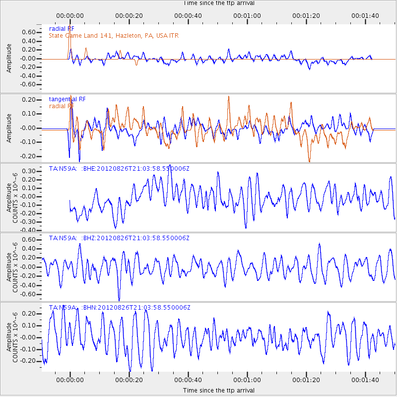
N59A State Game Land 141, Hazleton, PA, USA - Earthquake Result Viewer
*The percent match for this event was below the threshold and hence no stack was calculated.
| Earthquake location: |
Southern California |
| Earthquake latitude/longitude: |
33.0/-115.5 |
| Earthquake time(UTC): |
2012/08/26 (239) 20:57:58 GMT |
| Earthquake Depth: |
9.0 km |
| Earthquake Magnitude: |
5.5 MW, 5.3 MS, 5.0 MB, 5.5 MW |
| Earthquake Catalog/Contributor: |
WHDF/NEIC |
|
| Network: |
TA USArray Transportable Network (new EarthScope stations) |
| Station: |
N59A State Game Land 141, Hazleton, PA, USA |
| Lat/Lon: |
40.92 N/75.77 W |
| Elevation: |
508 m |
|
| Distance: |
32.5 deg |
| Az: |
64.409 deg |
| Baz: |
268.914 deg |
| Ray Param: |
$rayparam |
*The percent match for this event was below the threshold and hence was not used in the summary stack. |
|
| Radial Match: |
44.27385 % |
| Radial Bump: |
400 |
| Transverse Match: |
69.300804 % |
| Transverse Bump: |
400 |
| SOD ConfigId: |
469095 |
| Insert Time: |
2013-02-22 08:17:36.390 +0000 |
| GWidth: |
2.5 |
| Max Bumps: |
400 |
| Tol: |
0.001 |
|
Signal To Noise
| Channel | StoN | STA | LTA |
| TA:N59A: :BHZ:20120826T21:03:58.550006Z | 1.197383 | 2.2297664E-7 | 1.8621998E-7 |
| TA:N59A: :BHN:20120826T21:03:58.550006Z | 1.1334143 | 1.3134975E-7 | 1.15888554E-7 |
| TA:N59A: :BHE:20120826T21:03:58.550006Z | 2.5005593 | 2.8506415E-7 | 1.1400016E-7 |
| Arrivals |
| Ps | |
| PpPs | |
| PsPs/PpSs | |


