You are here: Home > Network List > G - GEOSCOPE Stations List
> Station UNM Unam,Mexico > Earthquake Result Viewer
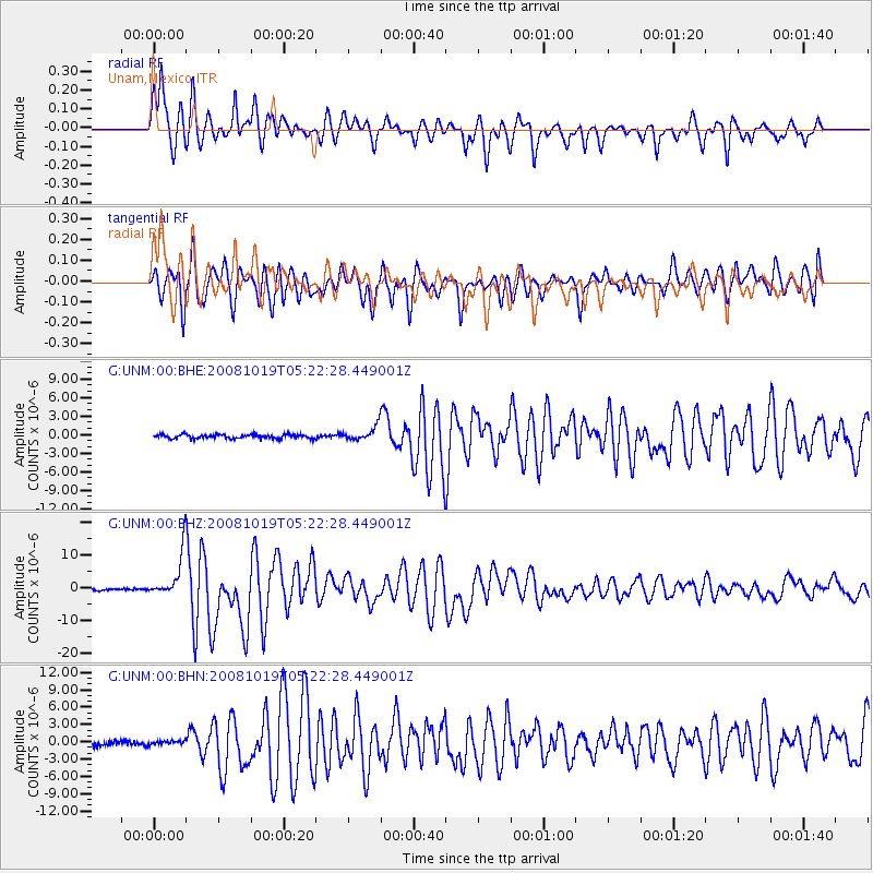
UNM Unam,Mexico - Earthquake Result Viewer
*The percent match for this event was below the threshold and hence no stack was calculated.
| Earthquake location: |
Tonga Islands |
| Earthquake latitude/longitude: |
-21.9/-173.8 |
| Earthquake time(UTC): |
2008/10/19 (293) 05:10:33 GMT |
| Earthquake Depth: |
29 km |
| Earthquake Magnitude: |
6.8 MB, 7.0 MS, 6.9 MW, 6.9 MW |
| Earthquake Catalog/Contributor: |
WHDF/NEIC |
|
| Network: |
G GEOSCOPE |
| Station: |
UNM Unam,Mexico |
| Lat/Lon: |
19.33 N/99.18 W |
| Elevation: |
2280 m |
|
| Distance: |
83.7 deg |
| Az: |
66.378 deg |
| Baz: |
244.327 deg |
| Ray Param: |
$rayparam |
*The percent match for this event was below the threshold and hence was not used in the summary stack. |
|
| Radial Match: |
91.70847 % |
| Radial Bump: |
400 |
| Transverse Match: |
85.813835 % |
| Transverse Bump: |
400 |
| SOD ConfigId: |
2556 |
| Insert Time: |
2010-02-27 00:37:34.075 +0000 |
| GWidth: |
2.5 |
| Max Bumps: |
400 |
| Tol: |
0.001 |
|
Signal To Noise
| Channel | StoN | STA | LTA |
| G:UNM:00:BHZ:20081019T05:22:28.449001Z | 24.498644 | 6.663591E-6 | 2.7199837E-7 |
| G:UNM:00:BHN:20081019T05:22:28.449001Z | 0.7842824 | 3.510154E-7 | 4.4756248E-7 |
| G:UNM:00:BHE:20081019T05:22:28.449001Z | 3.3813157 | 1.1261728E-6 | 3.3305759E-7 |
| Arrivals |
| Ps | |
| PpPs | |
| PsPs/PpSs | |


