
INK INUVIK, NT - Earthquake Result Viewer
| ||||||||||||||||||
| ||||||||||||||||||
| ||||||||||||||||||
|
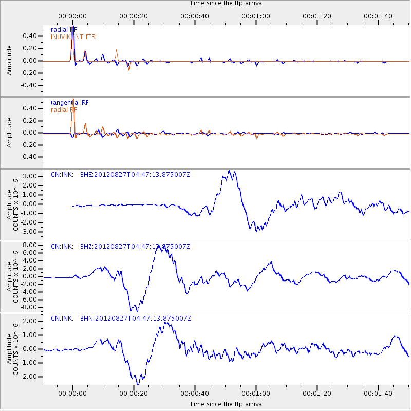
Signal To Noise
| Channel | StoN | STA | LTA |
| CN:INK: :BHZ:20120827T04:47:13.875007Z | 5.260736 | 2.799552E-7 | 5.3215974E-8 |
| CN:INK: :BHN:20120827T04:47:13.875007Z | 1.4043424 | 6.7072E-8 | 4.7760434E-8 |
| CN:INK: :BHE:20120827T04:47:13.875007Z | 1.4618155 | 9.301689E-8 | 6.363107E-8 |
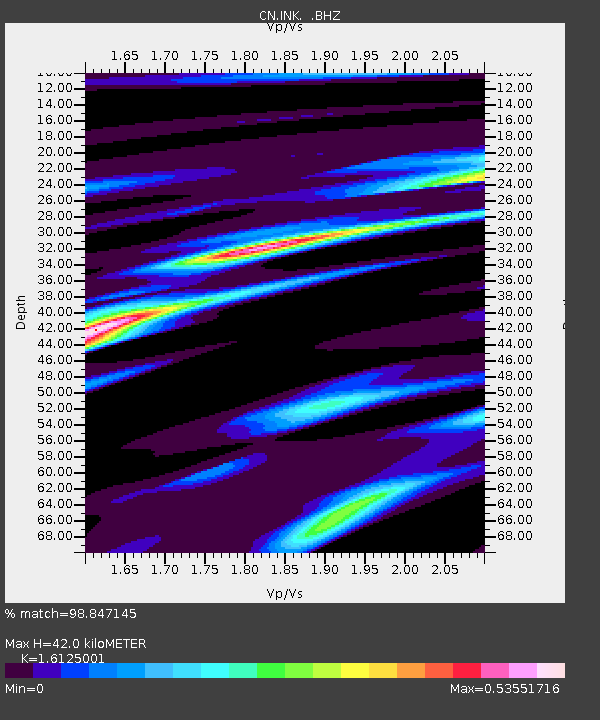
| Arrivals | |
| Ps | 4.4 SECOND |
| PpPs | 17 SECOND |
| PsPs/PpSs | 21 SECOND |

