You are here: Home > Network List > CI - Caltech Regional Seismic Network Stations List
> Station MPP McPhearson Peak > Earthquake Result Viewer
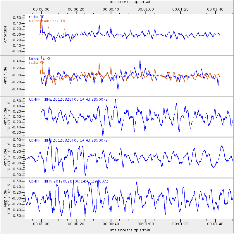
MPP McPhearson Peak - Earthquake Result Viewer
*The percent match for this event was below the threshold and hence no stack was calculated.
| Earthquake location: |
Off Coast Of Central America |
| Earthquake latitude/longitude: |
12.5/-88.7 |
| Earthquake time(UTC): |
2012/08/28 (241) 06:08:16 GMT |
| Earthquake Depth: |
35 km |
| Earthquake Magnitude: |
5.5 MW, 5.0 MS, 5.1 MB, 5.5 MW |
| Earthquake Catalog/Contributor: |
WHDF/NEIC |
|
| Network: |
CI Caltech Regional Seismic Network |
| Station: |
MPP McPhearson Peak |
| Lat/Lon: |
34.89 N/119.81 W |
| Elevation: |
1739 m |
|
| Distance: |
36.0 deg |
| Az: |
313.622 deg |
| Baz: |
120.669 deg |
| Ray Param: |
$rayparam |
*The percent match for this event was below the threshold and hence was not used in the summary stack. |
|
| Radial Match: |
77.67918 % |
| Radial Bump: |
400 |
| Transverse Match: |
64.601944 % |
| Transverse Bump: |
400 |
| SOD ConfigId: |
469095 |
| Insert Time: |
2013-02-22 08:45:02.111 +0000 |
| GWidth: |
2.5 |
| Max Bumps: |
400 |
| Tol: |
0.001 |
|
Signal To Noise
| Channel | StoN | STA | LTA |
| CI:MPP: :BHZ:20120828T06:14:43.295007Z | 4.175537 | 4.3671864E-7 | 1.04589816E-7 |
| CI:MPP: :BHN:20120828T06:14:43.295007Z | 1.1244438 | 1.6878627E-7 | 1.5010646E-7 |
| CI:MPP: :BHE:20120828T06:14:43.295007Z | 1.344311 | 2.0375306E-7 | 1.5156691E-7 |
| Arrivals |
| Ps | |
| PpPs | |
| PsPs/PpSs | |


