You are here: Home > Network List > TA - USArray Transportable Network (new EarthScope stations) Stations List
> Station A33A Warroad, MN, USA > Earthquake Result Viewer
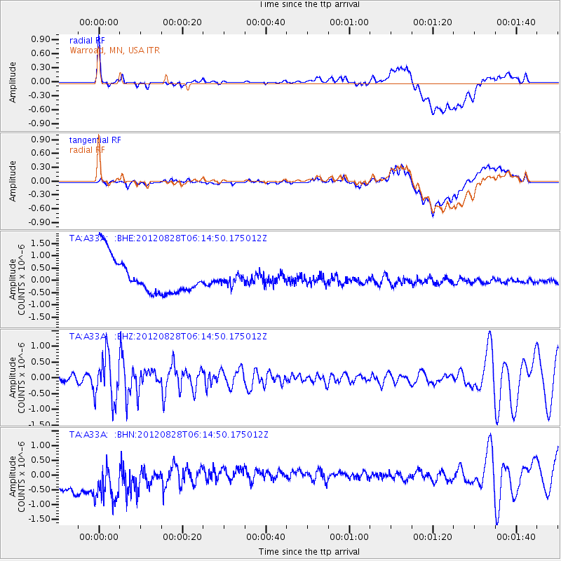
A33A Warroad, MN, USA - Earthquake Result Viewer
*The percent match for this event was below the threshold and hence no stack was calculated.
| Earthquake location: |
Off Coast Of Central America |
| Earthquake latitude/longitude: |
12.5/-88.7 |
| Earthquake time(UTC): |
2012/08/28 (241) 06:08:16 GMT |
| Earthquake Depth: |
35 km |
| Earthquake Magnitude: |
5.5 MW, 5.0 MS, 5.1 MB, 5.5 MW |
| Earthquake Catalog/Contributor: |
WHDF/NEIC |
|
| Network: |
TA USArray Transportable Network (new EarthScope stations) |
| Station: |
A33A Warroad, MN, USA |
| Lat/Lon: |
48.94 N/95.39 W |
| Elevation: |
329 m |
|
| Distance: |
36.8 deg |
| Az: |
352.58 deg |
| Baz: |
168.972 deg |
| Ray Param: |
$rayparam |
*The percent match for this event was below the threshold and hence was not used in the summary stack. |
|
| Radial Match: |
34.669544 % |
| Radial Bump: |
400 |
| Transverse Match: |
39.358494 % |
| Transverse Bump: |
400 |
| SOD ConfigId: |
469095 |
| Insert Time: |
2013-02-22 08:53:02.735 +0000 |
| GWidth: |
2.5 |
| Max Bumps: |
400 |
| Tol: |
0.001 |
|
Signal To Noise
| Channel | StoN | STA | LTA |
| TA:A33A: :BHZ:20120828T06:14:50.175012Z | 6.191325 | 7.132289E-7 | 1.1519811E-7 |
| TA:A33A: :BHN:20120828T06:14:50.175012Z | 1.2200207 | 1.3743758E-6 | 1.1265184E-6 |
| TA:A33A: :BHE:20120828T06:14:50.175012Z | 0.26448 | 1.8921304E-7 | 7.154153E-7 |
| Arrivals |
| Ps | |
| PpPs | |
| PsPs/PpSs | |


