You are here: Home > Network List > TA - USArray Transportable Network (new EarthScope stations) Stations List
> Station H40A Chili, WI, USA > Earthquake Result Viewer
H40A Chili, WI, USA - Earthquake Result Viewer

| Earthquake location: |
Off Coast Of Central America |
| Earthquake latitude/longitude: |
12.5/-88.7 |
| Earthquake time(UTC): |
2012/08/28 (241) 06:08:16 GMT |
| Earthquake Depth: |
35 km |
| Earthquake Magnitude: |
5.5 MW, 5.0 MS, 5.1 MB, 5.5 MW |
| Earthquake Catalog/Contributor: |
WHDF/NEIC |
|
| Network: |
TA USArray Transportable Network (new EarthScope stations) |
| Station: |
H40A Chili, WI, USA |
| Lat/Lon: |
44.62 N/90.39 W |
| Elevation: |
372 m |
|
| Distance: |
32.1 deg |
| Az: |
357.665 deg |
| Baz: |
176.806 deg |
| Ray Param: |
0.078746736 |
| Estimated Moho Depth: |
16.0 km |
| Estimated Crust Vp/Vs: |
1.74 |
| Assumed Crust Vp: |
6.571 km/s |
| Estimated Crust Vs: |
3.782 km/s |
| Estimated Crust Poisson's Ratio: |
0.25 |
|
| Radial Match: |
80.87477 % |
| Radial Bump: |
377 |
| Transverse Match: |
54.355785 % |
| Transverse Bump: |
325 |
| SOD ConfigId: |
469095 |
| Insert Time: |
2013-02-22 08:54:41.614 +0000 |
| GWidth: |
2.5 |
| Max Bumps: |
400 |
| Tol: |
0.001 |
|
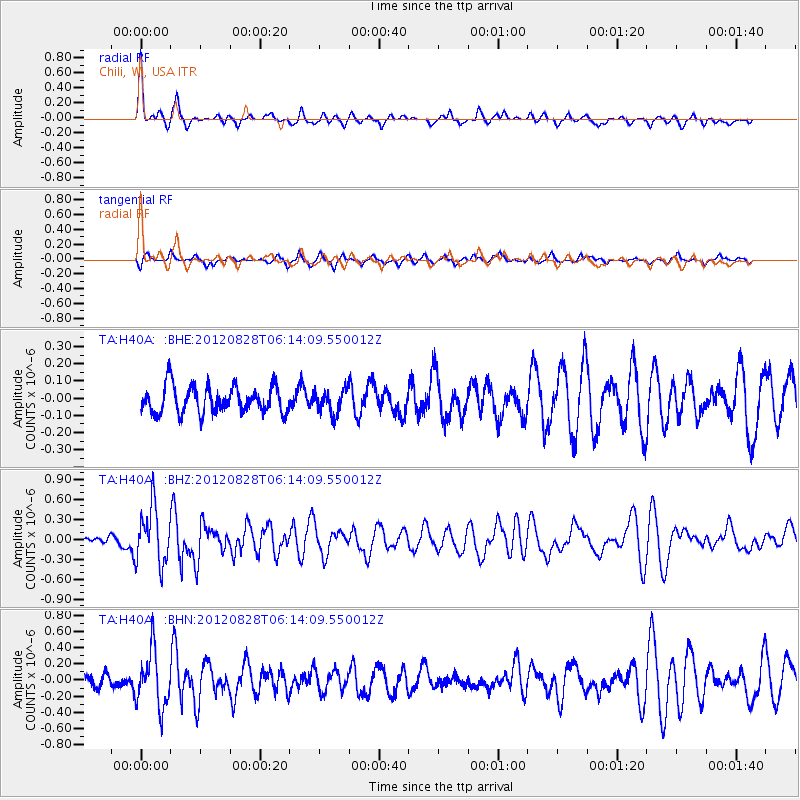
Signal To Noise
| Channel | StoN | STA | LTA |
| TA:H40A: :BHZ:20120828T06:14:09.550012Z | 4.559173 | 4.2257685E-7 | 9.2687166E-8 |
| TA:H40A: :BHN:20120828T06:14:09.550012Z | 3.4142098 | 3.380801E-7 | 9.9021484E-8 |
| TA:H40A: :BHE:20120828T06:14:09.550012Z | 0.8770692 | 6.764736E-8 | 7.712888E-8 |
| Arrivals |
| Ps | 2.0 SECOND |
| PpPs | 6.1 SECOND |
| PsPs/PpSs | 8.1 SECOND |


