You are here: Home > Network List > TA - USArray Transportable Network (new EarthScope stations) Stations List
> Station G43A Wallace, MI, USA > Earthquake Result Viewer
G43A Wallace, MI, USA - Earthquake Result Viewer
*The percent match for this event was below the threshold and hence no stack was calculated.
| Earthquake location: |
Off Coast Of Central America |
| Earthquake latitude/longitude: |
12.5/-88.7 |
| Earthquake time(UTC): |
2012/08/28 (241) 06:08:16 GMT |
| Earthquake Depth: |
35 km |
| Earthquake Magnitude: |
5.5 MW, 5.0 MS, 5.1 MB, 5.5 MW |
| Earthquake Catalog/Contributor: |
WHDF/NEIC |
|
| Network: |
TA USArray Transportable Network (new EarthScope stations) |
| Station: |
G43A Wallace, MI, USA |
| Lat/Lon: |
45.26 N/87.69 W |
| Elevation: |
213 m |
|
| Distance: |
32.7 deg |
| Az: |
1.266 deg |
| Baz: |
181.75 deg |
| Ray Param: |
$rayparam |
*The percent match for this event was below the threshold and hence was not used in the summary stack. |
|
| Radial Match: |
70.79332 % |
| Radial Bump: |
350 |
| Transverse Match: |
63.976357 % |
| Transverse Bump: |
400 |
| SOD ConfigId: |
469095 |
| Insert Time: |
2013-02-22 08:56:18.901 +0000 |
| GWidth: |
2.5 |
| Max Bumps: |
400 |
| Tol: |
0.001 |
|
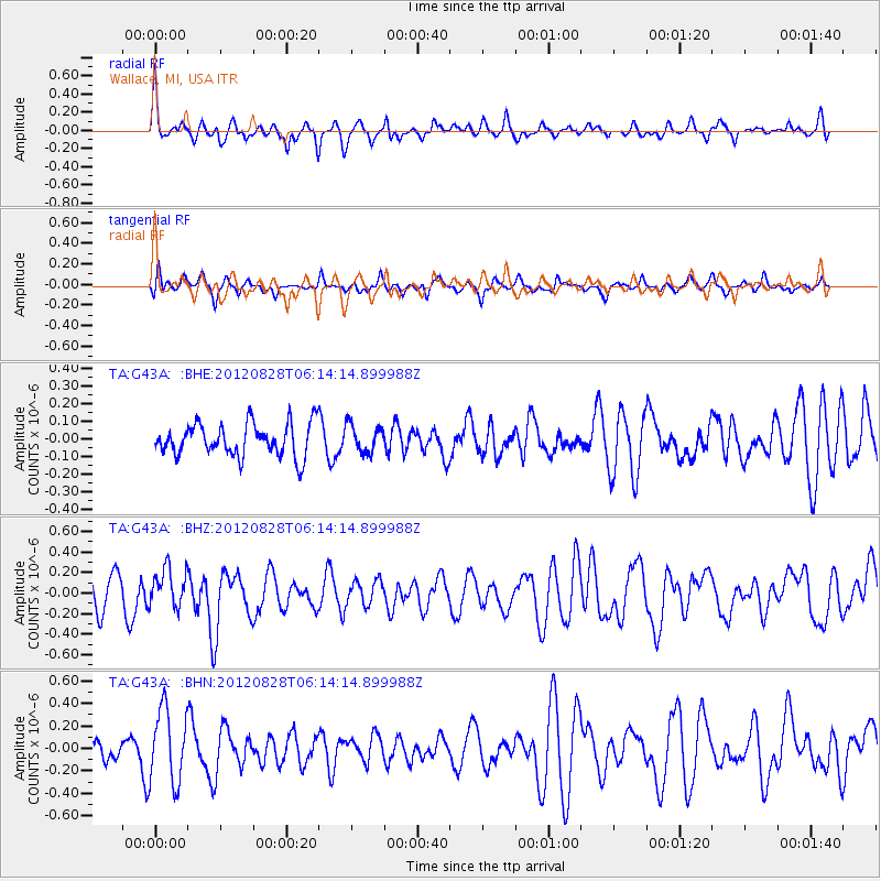
Signal To Noise
| Channel | StoN | STA | LTA |
| TA:G43A: :BHZ:20120828T06:14:14.899988Z | 1.5445621 | 1.880479E-7 | 1.2174836E-7 |
| TA:G43A: :BHN:20120828T06:14:14.899988Z | 4.4877315 | 3.2711515E-7 | 7.289098E-8 |
| TA:G43A: :BHE:20120828T06:14:14.899988Z | 0.8500776 | 7.7779276E-8 | 9.149667E-8 |
| Arrivals |
| Ps | |
| PpPs | |
| PsPs/PpSs | |


