You are here: Home > Network List > TA - USArray Transportable Network (new EarthScope stations) Stations List
> Station C40A Isle Royale National Park, MI, USA > Earthquake Result Viewer
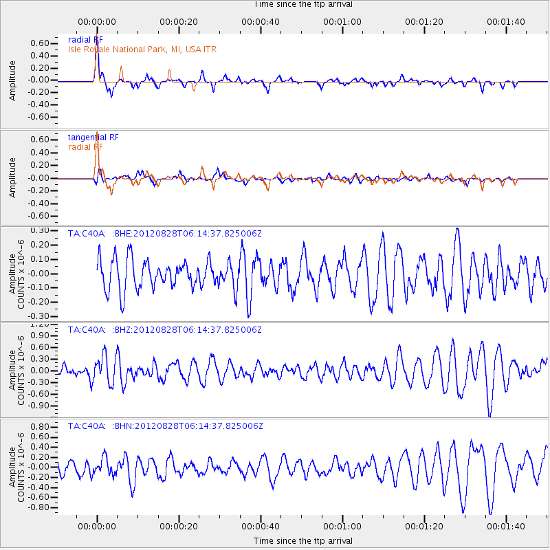
C40A Isle Royale National Park, MI, USA - Earthquake Result Viewer
*The percent match for this event was below the threshold and hence no stack was calculated.
| Earthquake location: |
Off Coast Of Central America |
| Earthquake latitude/longitude: |
12.5/-88.7 |
| Earthquake time(UTC): |
2012/08/28 (241) 06:08:16 GMT |
| Earthquake Depth: |
35 km |
| Earthquake Magnitude: |
5.5 MW, 5.0 MS, 5.1 MB, 5.5 MW |
| Earthquake Catalog/Contributor: |
WHDF/NEIC |
|
| Network: |
TA USArray Transportable Network (new EarthScope stations) |
| Station: |
C40A Isle Royale National Park, MI, USA |
| Lat/Lon: |
47.92 N/89.15 W |
| Elevation: |
216 m |
|
| Distance: |
35.3 deg |
| Az: |
359.422 deg |
| Baz: |
179.16 deg |
| Ray Param: |
$rayparam |
*The percent match for this event was below the threshold and hence was not used in the summary stack. |
|
| Radial Match: |
71.2132 % |
| Radial Bump: |
341 |
| Transverse Match: |
51.515293 % |
| Transverse Bump: |
400 |
| SOD ConfigId: |
469095 |
| Insert Time: |
2013-02-22 08:56:45.284 +0000 |
| GWidth: |
2.5 |
| Max Bumps: |
400 |
| Tol: |
0.001 |
|
Signal To Noise
| Channel | StoN | STA | LTA |
| TA:C40A: :BHZ:20120828T06:14:37.825006Z | 2.1495135 | 3.6053325E-7 | 1.6772785E-7 |
| TA:C40A: :BHN:20120828T06:14:37.825006Z | 1.6241459 | 1.5949902E-7 | 9.820486E-8 |
| TA:C40A: :BHE:20120828T06:14:37.825006Z | 0.8223663 | 8.489835E-8 | 1.03236665E-7 |
| Arrivals |
| Ps | |
| PpPs | |
| PsPs/PpSs | |


