You are here: Home > Network List > G - GEOSCOPE Stations List
> Station UNM Unam,Mexico > Earthquake Result Viewer
UNM Unam,Mexico - Earthquake Result Viewer

| Earthquake location: |
South Of Fiji Islands |
| Earthquake latitude/longitude: |
-24.1/-177.0 |
| Earthquake time(UTC): |
1996/04/16 (107) 00:30:54 GMT |
| Earthquake Depth: |
111 km |
| Earthquake Magnitude: |
6.4 MB, 6.8 MS, 7.1 UNKNOWN, 7.1 MW |
| Earthquake Catalog/Contributor: |
WHDF/NEIC |
|
| Network: |
G GEOSCOPE |
| Station: |
UNM Unam,Mexico |
| Lat/Lon: |
19.33 N/99.18 W |
| Elevation: |
2280 m |
|
| Distance: |
87.2 deg |
| Az: |
67.559 deg |
| Baz: |
243.472 deg |
| Ray Param: |
0.043237865 |
| Estimated Moho Depth: |
10.75 km |
| Estimated Crust Vp/Vs: |
1.60 |
| Assumed Crust Vp: |
6.597 km/s |
| Estimated Crust Vs: |
4.123 km/s |
| Estimated Crust Poisson's Ratio: |
0.18 |
|
| Radial Match: |
94.66704 % |
| Radial Bump: |
400 |
| Transverse Match: |
89.35935 % |
| Transverse Bump: |
400 |
| SOD ConfigId: |
6273 |
| Insert Time: |
2010-02-27 00:38:25.144 +0000 |
| GWidth: |
2.5 |
| Max Bumps: |
400 |
| Tol: |
0.001 |
|
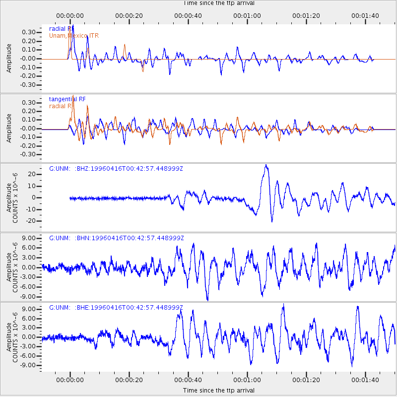
Signal To Noise
| Channel | StoN | STA | LTA |
| G:UNM: :BHN:19960416T00:42:57.448999Z | 1.3248339 | 7.859071E-7 | 5.9321184E-7 |
| G:UNM: :BHE:19960416T00:42:57.448999Z | 0.76823103 | 5.0293323E-7 | 6.5466406E-7 |
| G:UNM: :BHZ:19960416T00:42:57.448999Z | 2.8047373 | 1.6309573E-6 | 5.815009E-7 |
| Arrivals |
| Ps | 1.0 SECOND |
| PpPs | 4.1 SECOND |
| PsPs/PpSs | 5.1 SECOND |


