You are here: Home > Network List > CN - Canadian National Seismograph Network Stations List
> Station INK INUVIK, NT > Earthquake Result Viewer
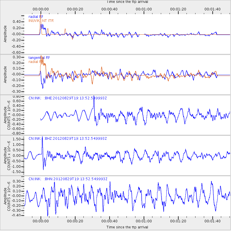
INK INUVIK, NT - Earthquake Result Viewer
*The percent match for this event was below the threshold and hence no stack was calculated.
| Earthquake location: |
Near East Coast Of Honshu, Japan |
| Earthquake latitude/longitude: |
38.4/141.8 |
| Earthquake time(UTC): |
2012/08/29 (242) 19:05:11 GMT |
| Earthquake Depth: |
47 km |
| Earthquake Magnitude: |
5.8 MB, 5.1 MS, 5.5 MW, 5.5 MW |
| Earthquake Catalog/Contributor: |
WHDF/NEIC |
|
| Network: |
CN Canadian National Seismograph Network |
| Station: |
INK INUVIK, NT |
| Lat/Lon: |
68.31 N/133.53 W |
| Elevation: |
44 m |
|
| Distance: |
53.0 deg |
| Az: |
27.612 deg |
| Baz: |
281.722 deg |
| Ray Param: |
$rayparam |
*The percent match for this event was below the threshold and hence was not used in the summary stack. |
|
| Radial Match: |
66.27329 % |
| Radial Bump: |
400 |
| Transverse Match: |
62.991188 % |
| Transverse Bump: |
400 |
| SOD ConfigId: |
469095 |
| Insert Time: |
2013-02-22 09:08:02.427 +0000 |
| GWidth: |
2.5 |
| Max Bumps: |
400 |
| Tol: |
0.001 |
|
Signal To Noise
| Channel | StoN | STA | LTA |
| CN:INK: :BHZ:20120829T19:13:52.549993Z | 2.7776499 | 6.1575895E-7 | 2.2168344E-7 |
| CN:INK: :BHN:20120829T19:13:52.549993Z | 1.390492 | 1.5054667E-7 | 1.0826863E-7 |
| CN:INK: :BHE:20120829T19:13:52.549993Z | 2.8091471 | 3.1777878E-7 | 1.13122866E-7 |
| Arrivals |
| Ps | |
| PpPs | |
| PsPs/PpSs | |


