You are here: Home > Network List > TA - USArray Transportable Network (new EarthScope stations) Stations List
> Station 109C Camp Elliot, Mirimar, CA, USA > Earthquake Result Viewer
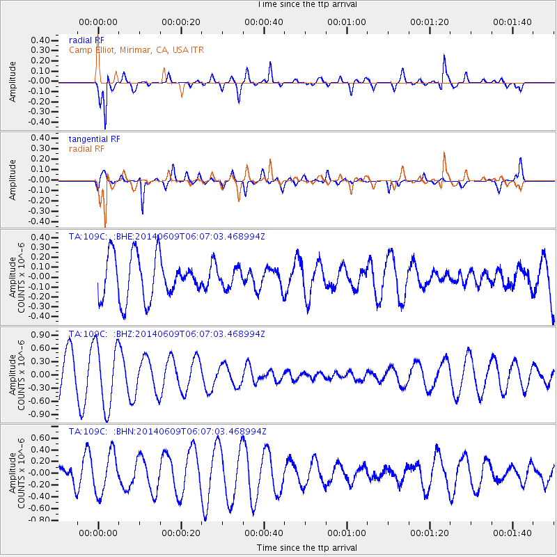
109C Camp Elliot, Mirimar, CA, USA - Earthquake Result Viewer
*The percent match for this event was below the threshold and hence no stack was calculated.
| Earthquake location: |
South Of Tonga Islands |
| Earthquake latitude/longitude: |
-25.6/-174.3 |
| Earthquake time(UTC): |
2014/06/09 (160) 05:55:27 GMT |
| Earthquake Depth: |
10 km |
| Earthquake Magnitude: |
4.7 MW |
| Earthquake Catalog/Contributor: |
ISC/ISC |
|
| Network: |
TA USArray Transportable Network (new EarthScope stations) |
| Station: |
109C Camp Elliot, Mirimar, CA, USA |
| Lat/Lon: |
32.89 N/117.11 W |
| Elevation: |
150 m |
|
| Distance: |
79.6 deg |
| Az: |
45.954 deg |
| Baz: |
230.507 deg |
| Ray Param: |
$rayparam |
*The percent match for this event was below the threshold and hence was not used in the summary stack. |
|
| Radial Match: |
77.00666 % |
| Radial Bump: |
321 |
| Transverse Match: |
78.88499 % |
| Transverse Bump: |
400 |
| SOD ConfigId: |
3390531 |
| Insert Time: |
2019-04-12 05:24:37.855 +0000 |
| GWidth: |
2.5 |
| Max Bumps: |
400 |
| Tol: |
0.001 |
|
Signal To Noise
| Channel | StoN | STA | LTA |
| TA:109C: :BHZ:20140609T06:07:03.468994Z | 1.6735909 | 7.2724214E-7 | 4.3453997E-7 |
| TA:109C: :BHN:20140609T06:07:03.468994Z | 2.4667656 | 3.5477942E-7 | 1.4382373E-7 |
| TA:109C: :BHE:20140609T06:07:03.468994Z | 0.43070558 | 9.261896E-8 | 2.1504007E-7 |
| Arrivals |
| Ps | |
| PpPs | |
| PsPs/PpSs | |


