You are here: Home > Network List > TA - USArray Transportable Network (new EarthScope stations) Stations List
> Station O03D Paynes Creek, CA, USA > Earthquake Result Viewer
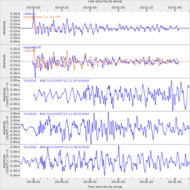
O03D Paynes Creek, CA, USA - Earthquake Result Viewer
*The percent match for this event was below the threshold and hence no stack was calculated.
| Earthquake location: |
Santa Cruz Islands |
| Earthquake latitude/longitude: |
-12.5/166.5 |
| Earthquake time(UTC): |
2012/09/05 (249) 13:09:10 GMT |
| Earthquake Depth: |
27 km |
| Earthquake Magnitude: |
5.6 MB, 5.7 MS, 6.0 MW, 6.0 MW |
| Earthquake Catalog/Contributor: |
WHDF/NEIC |
|
| Network: |
TA USArray Transportable Network (new EarthScope stations) |
| Station: |
O03D Paynes Creek, CA, USA |
| Lat/Lon: |
40.29 N/121.80 W |
| Elevation: |
968 m |
|
| Distance: |
84.5 deg |
| Az: |
46.846 deg |
| Baz: |
248.679 deg |
| Ray Param: |
$rayparam |
*The percent match for this event was below the threshold and hence was not used in the summary stack. |
|
| Radial Match: |
70.58038 % |
| Radial Bump: |
400 |
| Transverse Match: |
70.381744 % |
| Transverse Bump: |
394 |
| SOD ConfigId: |
469095 |
| Insert Time: |
2013-02-22 10:10:21.322 +0000 |
| GWidth: |
2.5 |
| Max Bumps: |
400 |
| Tol: |
0.001 |
|
Signal To Noise
| Channel | StoN | STA | LTA |
| TA:O03D: :BHZ:20120905T13:21:08.92499Z | 1.9447796 | 2.4822842E-7 | 1.2763833E-7 |
| TA:O03D: :BHN:20120905T13:21:08.92499Z | 0.98033947 | 1.1971127E-7 | 1.2211206E-7 |
| TA:O03D: :BHE:20120905T13:21:08.92499Z | 1.1127613 | 1.5828178E-7 | 1.4224234E-7 |
| Arrivals |
| Ps | |
| PpPs | |
| PsPs/PpSs | |


