You are here: Home > Network List > GS - US Geological Survey Networks Stations List
> Station DEC12 Boyd Road Surface Site > Earthquake Result Viewer
DEC12 Boyd Road Surface Site - Earthquake Result Viewer
*The percent match for this event was below the threshold and hence no stack was calculated.
| Earthquake location: |
Near Coast Of Peru |
| Earthquake latitude/longitude: |
-15.9/-75.1 |
| Earthquake time(UTC): |
2014/06/10 (161) 17:11:09 GMT |
| Earthquake Depth: |
30 km |
| Earthquake Magnitude: |
4.7 mb |
| Earthquake Catalog/Contributor: |
ISC/ISC |
|
| Network: |
GS US Geological Survey Networks |
| Station: |
DEC12 Boyd Road Surface Site |
| Lat/Lon: |
39.91 N/88.91 W |
| Elevation: |
208 m |
|
| Distance: |
57.0 deg |
| Az: |
347.314 deg |
| Baz: |
164.052 deg |
| Ray Param: |
$rayparam |
*The percent match for this event was below the threshold and hence was not used in the summary stack. |
|
| Radial Match: |
67.25482 % |
| Radial Bump: |
400 |
| Transverse Match: |
69.80221 % |
| Transverse Bump: |
400 |
| SOD ConfigId: |
3390531 |
| Insert Time: |
2019-04-12 05:44:07.771 +0000 |
| GWidth: |
2.5 |
| Max Bumps: |
400 |
| Tol: |
0.001 |
|
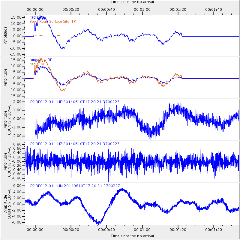
Signal To Noise
| Channel | StoN | STA | LTA |
| GS:DEC12:01:HHZ:20140610T17:20:21.370022Z | 1.0426695 | 2.6155024E-7 | 2.5084674E-7 |
| GS:DEC12:01:HHN:20140610T17:20:21.370022Z | 2.6946366 | 3.8198405E-6 | 1.4175716E-6 |
| GS:DEC12:01:HHE:20140610T17:20:21.370022Z | 1.1602783 | 6.677814E-7 | 5.755356E-7 |
| Arrivals |
| Ps | |
| PpPs | |
| PsPs/PpSs | |


