You are here: Home > Network List > G - GEOSCOPE Stations List
> Station UNM Unam,Mexico > Earthquake Result Viewer
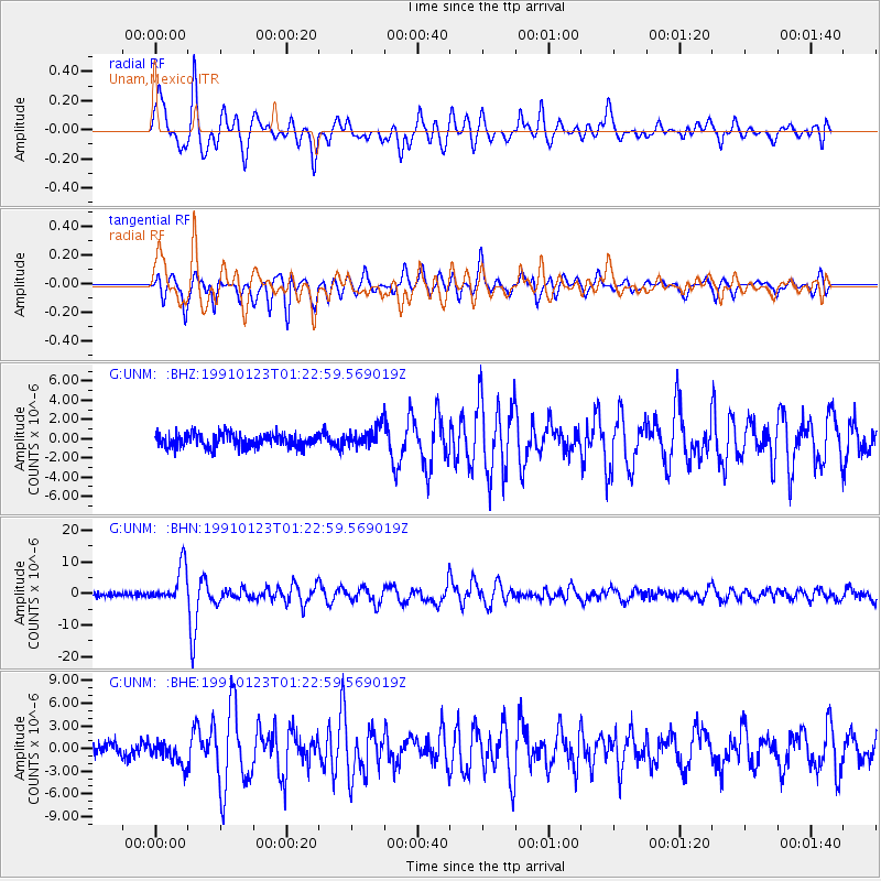
UNM Unam,Mexico - Earthquake Result Viewer
*The percent match for this event was below the threshold and hence no stack was calculated.
| Earthquake location: |
Rat Islands, Aleutian Islands |
| Earthquake latitude/longitude: |
52.0/178.9 |
| Earthquake time(UTC): |
1991/01/23 (023) 01:12:30 GMT |
| Earthquake Depth: |
116 km |
| Earthquake Magnitude: |
5.9 MB |
| Earthquake Catalog/Contributor: |
WHDF/NEIC |
|
| Network: |
G GEOSCOPE |
| Station: |
UNM Unam,Mexico |
| Lat/Lon: |
19.33 N/99.18 W |
| Elevation: |
2280 m |
|
| Distance: |
70.1 deg |
| Az: |
83.922 deg |
| Baz: |
319.402 deg |
| Ray Param: |
$rayparam |
*The percent match for this event was below the threshold and hence was not used in the summary stack. |
|
| Radial Match: |
83.505516 % |
| Radial Bump: |
400 |
| Transverse Match: |
82.97563 % |
| Transverse Bump: |
400 |
| SOD ConfigId: |
4480 |
| Insert Time: |
2010-02-27 00:41:27.972 +0000 |
| GWidth: |
2.5 |
| Max Bumps: |
400 |
| Tol: |
0.001 |
|
Signal To Noise
| Channel | StoN | STA | LTA |
| G:UNM: :BHN:19910123T01:22:59.569019Z | 9.3435755 | 5.7543075E-6 | 6.158571E-7 |
| G:UNM: :BHE:19910123T01:22:59.569019Z | 1.8065964 | 1.5221918E-6 | 8.4257437E-7 |
| G:UNM: :BHZ:19910123T01:22:59.569019Z | 1.5076623 | 1.0705891E-6 | 7.1009873E-7 |
| Arrivals |
| Ps | |
| PpPs | |
| PsPs/PpSs | |


