You are here: Home > Network List > G - GEOSCOPE Stations List
> Station UNM Unam,Mexico > Earthquake Result Viewer
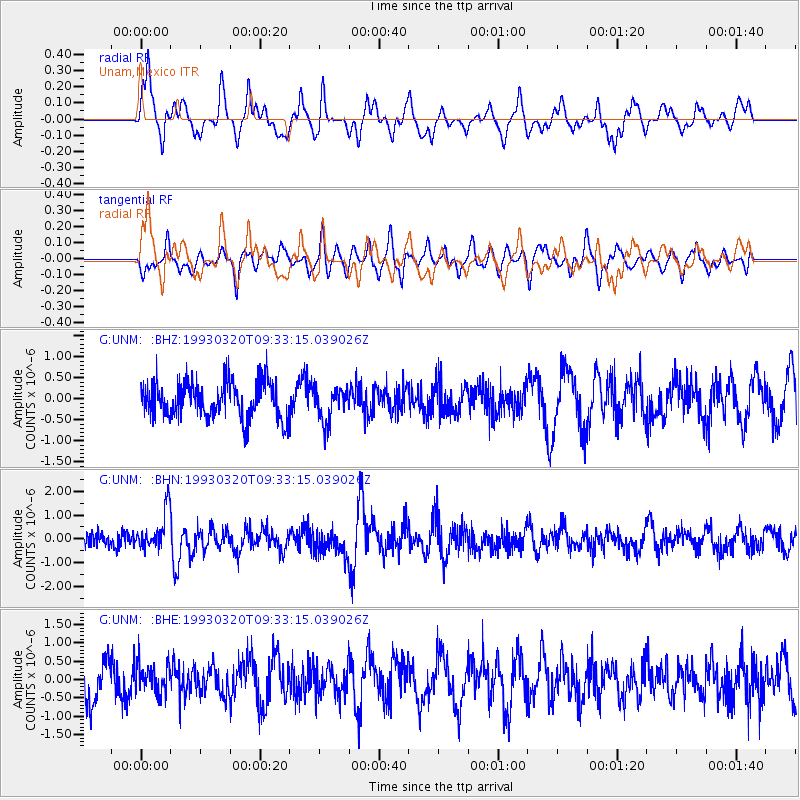
UNM Unam,Mexico - Earthquake Result Viewer
*The percent match for this event was below the threshold and hence no stack was calculated.
| Earthquake location: |
South Sandwich Islands Region |
| Earthquake latitude/longitude: |
-56.1/-27.9 |
| Earthquake time(UTC): |
1993/03/20 (079) 09:20:34 GMT |
| Earthquake Depth: |
130 km |
| Earthquake Magnitude: |
5.9 MB |
| Earthquake Catalog/Contributor: |
WHDF/NEIC |
|
| Network: |
G GEOSCOPE |
| Station: |
UNM Unam,Mexico |
| Lat/Lon: |
19.33 N/99.18 W |
| Elevation: |
2280 m |
|
| Distance: |
95.9 deg |
| Az: |
295.978 deg |
| Baz: |
147.747 deg |
| Ray Param: |
$rayparam |
*The percent match for this event was below the threshold and hence was not used in the summary stack. |
|
| Radial Match: |
58.12465 % |
| Radial Bump: |
368 |
| Transverse Match: |
65.680046 % |
| Transverse Bump: |
400 |
| SOD ConfigId: |
4480 |
| Insert Time: |
2010-02-27 00:42:09.800 +0000 |
| GWidth: |
2.5 |
| Max Bumps: |
400 |
| Tol: |
0.001 |
|
Signal To Noise
| Channel | StoN | STA | LTA |
| G:UNM: :BHN:19930320T09:33:15.039026Z | 2.7185032 | 8.246435E-7 | 3.0334468E-7 |
| G:UNM: :BHE:19930320T09:33:15.039026Z | 0.79935944 | 3.788445E-7 | 4.7393507E-7 |
| G:UNM: :BHZ:19930320T09:33:15.039026Z | 0.9100349 | 3.9325832E-7 | 4.3213544E-7 |
| Arrivals |
| Ps | |
| PpPs | |
| PsPs/PpSs | |


